
Rarely does this blog delve into commenting about additions to buildings. Rarely though in St. Louis do building additions come to affect such prominent architectural treasures as the St. Louis Art Museum. While our fair City is blessed with a seemingly never ending plethora of beautiful historic structures from single family homes to highrises, I could probably count on one hand the number of buildings in St. Louis that combine such an amazing site, importance of use, prominence to the public, and of course a spectacular work of architecture as Cass Gilbert's Palace of Fine Art. Before commentary about the current expansion though, we should take a look at the museum's beginnings in Forest Park and an early unexecuted concept for its expansion.
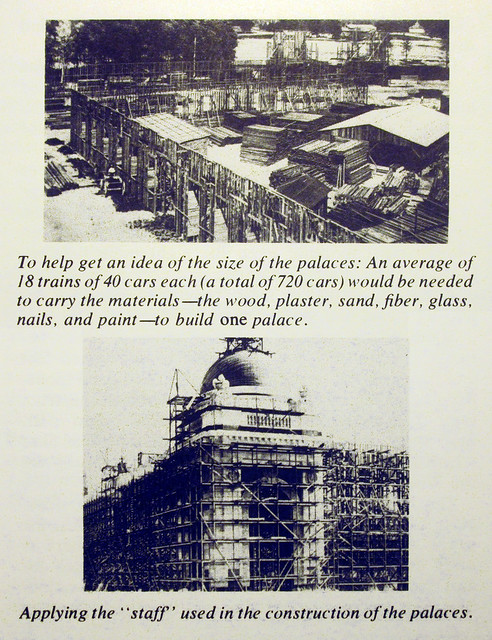
Many St. Lousians are familiar with the knowledge that the St. Louis Art Museum was the only permanent building constructed in Forest Park for the Louisiana Purchase Exposition, the World's Fair of 1904. All of the other great palaces for the fair were built as temporary buildings constructed of wood and a plaster material known as staff. The buildings were essentially giant stage sets that were dismantled after the fair.
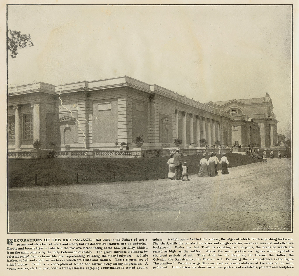
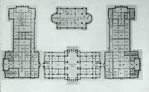
What many may not know, is that during the fair, the Palace of Art was actually composed of three large buildings designed by Cass Gilbert and a small annex. The Sanborn map below shows the Art Museum as we know it as the fireproof structure shown shaded brown as having an area of 60,000 s.f. The photo above from a large book The Official Photographic Views of the Universal Exposition shows the Art Palace complex with the east pavilion in the foreground.
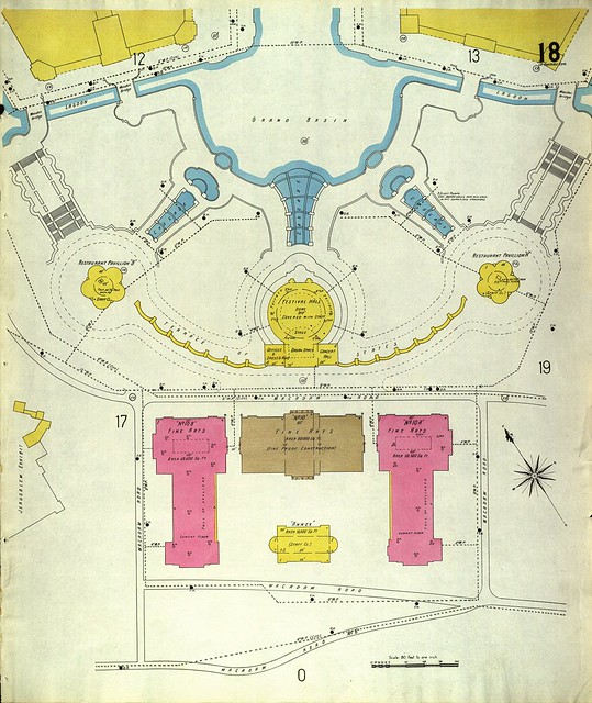
On each side of the main museum building were what have been called temporary pavilions, each with an area of 68,600 square feet (the new expansion will have about 80,000 square feet of new gallery and public amenity space). The puzzling part is that these pavilions were not made of wood and staff, but are shown on the Sanborn map as being constructed of masonry, which seems odd for temporary structures.
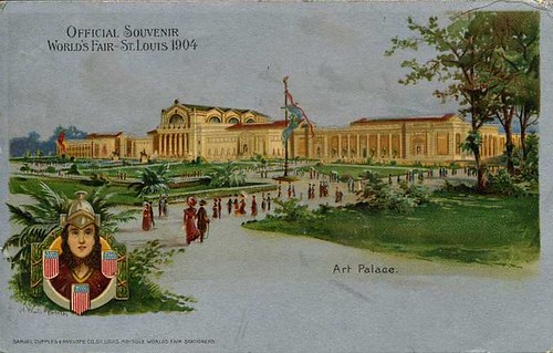
A official souvenir postcard depiction of the Art Palace complex shows the panels between the columns of the east and west pavilion buildings as light brown in color, which were probably the same buff colored brick that can still be seen on the clerestory and rear elevation of the main museum building. If the east and west pavilions were always intended to be temporary, it is likely that the columns, cornices and other decorative features were constructed of staff.
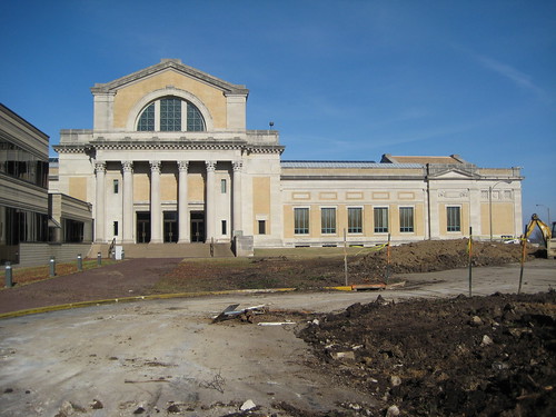
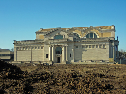
The south elevation of the St. Louis Art Museum just prior to construction of the new addition.
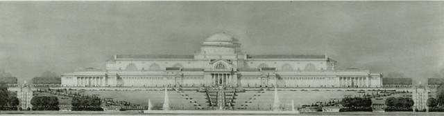
In 1915 the trustees of the City Art Museum commissioned Cass Gilbert to design an expansion of the museum. Gilbert responded with a massive scheme completed the following year, which would have been about eight times the area of the original structure. The sculpture hall would have been lengthened to the south and culminating in a large dome at the center of the complex. To get an idea of the scale of the concept, in the rendering of the north elevation above the ends original museum align with two large fountains in the grand basin and the new wings, each the length of the entire original building extend to the east and west.
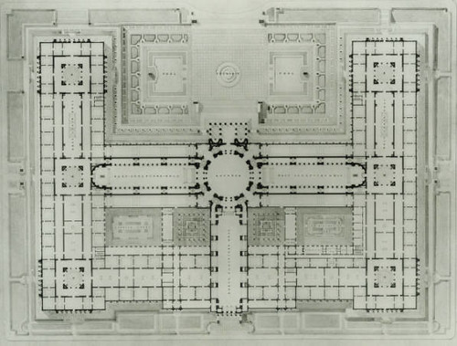
In the plan above, the corner rooms of the original building are joined by narrow galleries to the new central spine containing two additional large sculpture halls forming what appear to be two square courtyards, but are labeled atriums. The expansion designed to be constructed in phases for which Cass outlined construction costs in February 1917. The total estimated cost, which was broken down into 15 potential phases, was just under $8 million. The estimated cost was for the building components only.
In true City Beautiful style, the expansion scheme site plan is also nothing less than grand with a series of linear pools and symmetrical tree lined allees extending to a traffic circle with a monument on Lindell Boulevard. The Jefferson Memorial of the present day Missouri History Museum, which had been constructed in 1913, is just left of the traffic circle. The site plan was heavily influenced by remains of the site plan for the World's Fair, which also extended along this axis with the fair entrance on Lindell.

In 1917 Harland Bartholomew and the City Plan Commission published Problems of St. Louis, which outlined issues associated with the City's growth and necessary future improvements. Among topics of transit, streets, distribution of park space, curing "housing evils", the need for a large expansion of the City Art Museum did not show up as a priority.
4 comments:
Ah, I found it! Wonderful post, this is!
I'm especially interested in museum design right now, so will enjoy spending some time with this. . . thanks!
-Melinda
Wow, fascinating post! Amazing, thank you!
What were the sources you used for this post? I am writing my thesis on this building and found a lot of your information useful but I would also like to see the original sources if possible. Thank you!
Hallie, The first image came from some book I have about the fair (can't remember which one). The first image of the museum and more prominently the east "temporary" building during the fair is from the official photograph catalog from the fair, which I have a copy of. Let me know if you need more info on that. The site plan from the fair is a Sanborn map that can be found here: http://digital.library.umsystem.edu/cgi/i/image/image-idx?page=index;c=umcscsanic
Interesting note about that: Pink on a Sanborm map means the exterior walls were brick. Most of the other giant fair palaces show up yellow, indicating they were wood frame.
The postcard with the floor plan on the back is one I found online (can't recall where). All the rest of the images of the unexecuted expansion plan came from the Art Museums collection. I believe there is a link to these somewhere on their website.
Post a Comment