
 The elevated lanes just north of the Arch Grounds
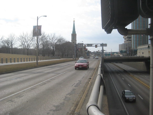 Memorial Drive and the Depressed Lanes below which carry
 only 4 lanes of traffic - the same as the New River Bridge
Rarely do I promote demolition on this site, but this is one structure whose removal would vastly improve the urban landscape. For as long as the Gateway Arch has graced St. Louis, Interstate 70 has functioned as both a physical and psychological barrier between the City and it's iconic symbol as well as the riverfront beyond. Also cut-off from Downtown are the historic Laclede's Landing and Chouteau's Landing districts to the north and south of the Arch.
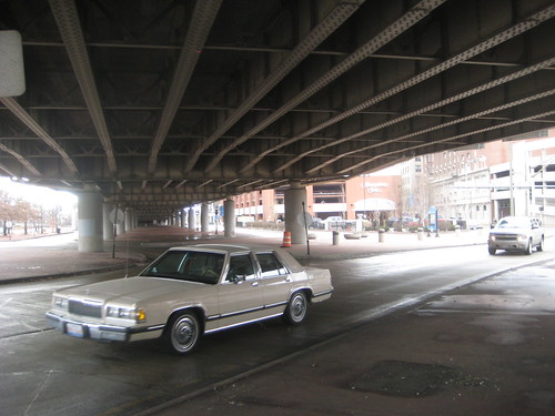 The space under the elevated lanes has about the same ambiance as that
under the St. Louis Centre bridges, but this extends for several blocks
In what is a very unusual arrangement, the National Park Service owns the land under the interstate and to the western boundary of Memorial Drive (formerly 3rd Street) and leases it to MODOT. In approximately 2015, construction will likely be complete on the New Mississippi River north of Downtown St. Louis officially re-routing I-70 and a good portion of it's traffic to the East Side from its current alignment west of the Arch Grounds to the Poplar Street Bridge. Currently the plan is to keep the current highway between the New River Bridge and the PSB and simply re-name it I-44.
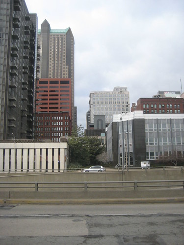
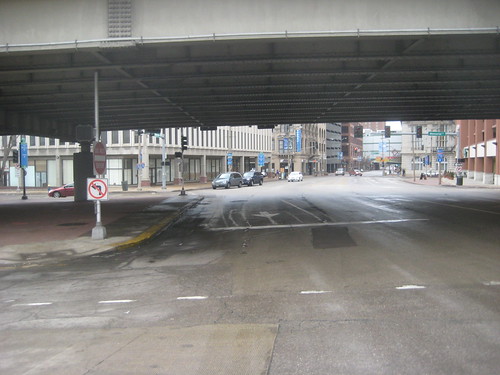 The view into Downtown at the end of the Eads Bridge. Welcome to St. Louis!
We can do better than this, right?
Since traffic will be reduced on this stretch of roadway, however there could be a better solution: Eliminate the depressed and elevated structures and merge the lanes with Memorial Drive as an attractive landscaped urban boulevard. This may sound extreme, but this same concept has been accomplished in cities across North America including Portland, San Francisco, Toronto, Milwaukee, and several others. Take a look at some examples here.

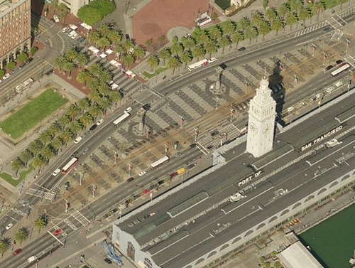 The Embarcadero today after removal of the freeway
Currently the National Park Service is going through a planning process to adopt a new General Management Plan which will guide the management as well as potential improvements to the Jefferson National Expansion Memorial (the Gateway Arch and surrounding grounds) for the next 15-20 years. Through midnight Monday, the NPS is taking public comments and ideas to help them finalize the Draft General Management Plan which lists several concepts and alternatives. None of the concepts currently include looking at changes to I-70 except a limited "lid" over a portion of the depressed lanes. This would only solve a small portion of the problem of the I-70 barrier, and leave the oppressive elevated highway structure un-touched.
 Separation anxiety. The proposed "Lid" focusing only on three blocks
would do nothing for the Olive Street corridor and blocks north
If you would like to see a more visionary plan for the areas bordering the Arch Grounds (such as removing the freeway) or of you have ideas for the grounds themselves, please take a moment to fill out the on-line comment form and submit your thoughts.
3 comments:
Make sure to look into the interstates in Baltimore; none of them were completed downtown so you have some unique situations there of boulevards such as President Street south of the Jones Falls Expressway as examples of such transitions.
I'd rather keep the highway. Destroying freeways is a dumb idea.
Post a Comment