 I'll start this post by saying that I support keeping the NGA within the City of St. Louis. Not only does the City need the 1% tax revenue from the 3,100 jobs, but there are the secondary and non-monetary benefits of keeping 3,100 people employed in the center or the City.
As you may have already seen, the NGA recently released the Draft Environmental Impact Statement (DIES) which is an evaluation of the social and environmental impacts and benefits of constructing the new NGA campus at each of the four locations that are in the running for the development.
Besides supporting a location within the City of St. Louis, my comments revolve around preservation of historic and cultural features that are located within the current City site boundary. The City of St. Louis established the site boundary and with a wave of the planners hand, assumes automatic destruction of everything within the roughly rectangular area set bound by Jefferson Avenue, Cass Avenue, 22nd Street and the alley south of St. Louis Avenue.
This practice of clear-cut demolition of everything in a 24 block 99 acre areas of the City reeks of 1950's and 60's "urban removal" planning that permanently scarred cities across the US including many areas of St. Louis. The big difference here is that most of the land under consideration is already vacant, but that should not condemn everything that is left to destruction if the opportunity exists for strategic preservation.
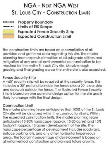
Does the NGA need all 99 acres being proposed? According to the DIES, NO.
The DIES states that the NGA vetted 186 potential sites prior to narrowing down to the current four in contention. One of the filters listed was that the site had to be at least 50 acres, not 100 acres. This is a big difference in site size. While the other sites under consideration are 101 acres, 167 acres and 182 acres, the fact remains that 99 acres is not a requirement according to the DIES.
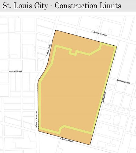 The graphic above from the DIES shows a proposed security fence that cuts into the site at the northwest and southeast corners, which correspond to the 2500 block of Montgomery, which is located within the St. Louis Place National Register Historic District and to the Rhema Baptist Church, which was at one time carved out of the NGA site boundary.
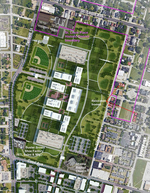
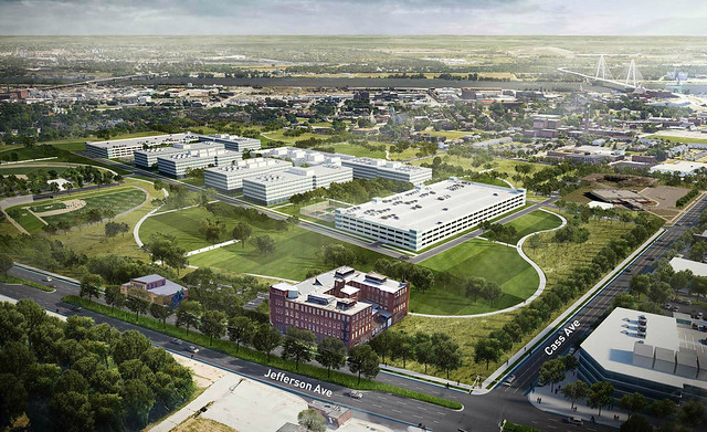 The modified site plan at the top of this post and the modified aerial rendering above represent what is possible with targeted preservation of historic and cultural resources. It should be noted that the site layout and buildings shown in the base images are a theoretical plan produced by the St. Louis Development Corporation and packaged in a site briefing book meant to sell the NGA on this site.
 Starting near the intersection of Cass & Jefferson is the former Buster Brown Blue Ribbon Shoe Factory, which is listed on the National Register of Historic Places This historic 4-story brick structure is occupied and in-use by St. Louis Sales & Manufacturing, a cabinet and countertop outlet.
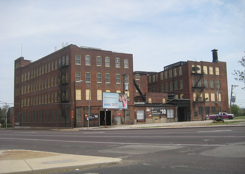 While it doesn't front on the intersection, the rear of former Buster Brown factory still presents a strong urban presence at Cass & Jefferson.
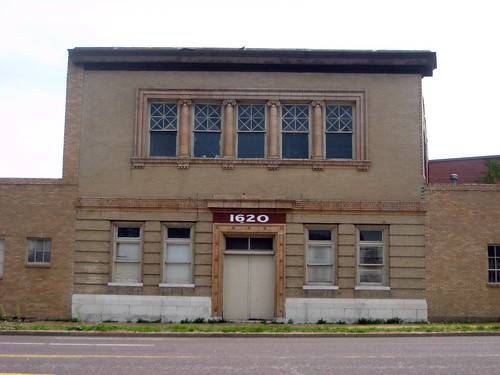
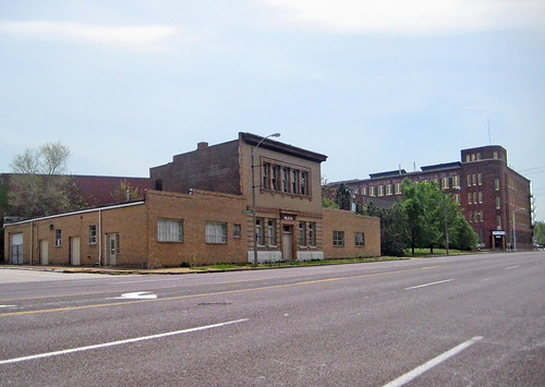 A block north of the shoe factory is a stately two story structure that was an addition to the Homeopathic Medical College of Missouri. Under current requirements for National Register listing, because the original college building located on the corner was long ago demolished, the addition lacks "integrity" and is technically ineligible for listing on the National Register. As a result, the building is ineligible for protection under Section 106 which reviews impacts of federally funded projects on historic resources.
 As Michael Allen points out in his article "Is the National Register of Historic Places Helping or Hindering Legacy City Preservation?", maybe it is time for a change to the hard and fast rules that often result in the demolition of buildings worthy of preserving. I strongly agree.
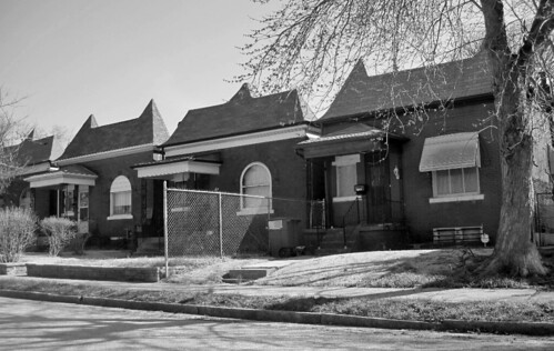 A few blocks north off Parnell the 2500 block of Montgomery, which is within the proposed NGA and part of the St. Louis Place National Register Historic District (photo from the districts nomination). With 15 homes tightly spaced in a row, this is by far is the most intact block within the proposed NGA site. As mentioned above, this block lies outside the potential security NGA fence line.
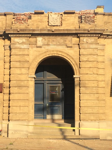
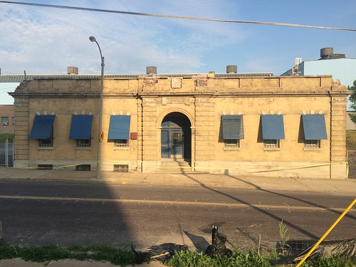
 The Rhema Baptist Church at the corner of 23rd & Cass, while not historic or architecturally significant, could certainly be considered a cultural asset worthy of consideration.
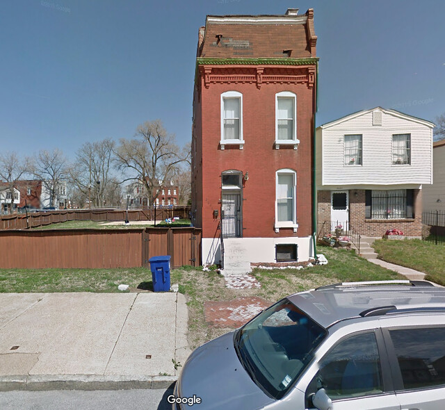
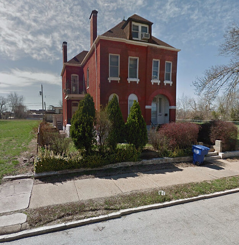 As you have probably have heard, the St. Louis Board of Alderman have approved the use of eminent domain to acquire property to assemble the site for the NGA. As of last week 66 property owners have already agreed to buy-outs including an offer to a longtime homeowner Charlesetta Taylor to move there three story circa 1894 house on North Market pictured above to a lot off-site. Taylor also happened to be a longtime opponent of the City effort to lure the NGA to North St. Louis.
The agreement to move this beautiful residence is very welcome news, but many other home owners live in beautiful structures that could be demolished. Another homeowner, Joyce Cooks, who has lived in a three story 15 room home for 40 years is rightly concerned with how she would replace such a house. The right thing to do is to offer every owner of these irreplaceable solid brick homes the same opportunity to move their homes to existing vacant lots outside of the NGA site area. This could actually strengthen the area around St. Louis Place Park by moving stable owners and their well cared for homes to the neighborhood around the park.
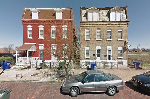
Below are several examples of structures that had they been built a few blocks east would be contributing properties in one of two National Register Historic Districts, but because of "loss of integrity" the homes (and owners) are considered disposable.
 2236 Warren Street - built in 1893
 2243 Benton Street - built in 1886
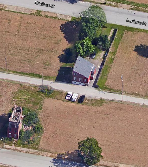 2318 Madison Street - a rare flounder house built in 1892
 2321-23 and 2325-27 built in 1887 and 1889
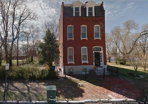
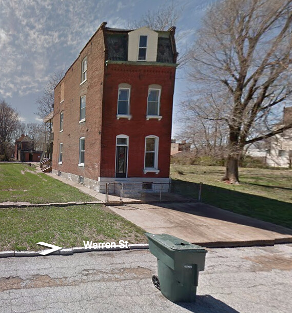 2220 Warren Street - built in 1891
While moving these houses may be more expensive in the short run than buy-out and demolition, the long term benefit to the larger neighborhood is worth it and the money saved not buying out the Buster Brown Shoe Factory and Rhema Baptist Church would more than cover these added development costs, and would result in a more intact neighborhood instead of the appearance of a giant spaceship like building landing on wasteland in the middle of the City.
 In the discussions revolving around the proposed new St. Louis NFL riverfront stadium ranging from the destruction of an entire historic district to whether the people of St. Louis should be able to vote to use their tax dollars to whether we need a new stadium at all, one ingredient has been missing: the fate of Al's Restaurant (also known as Al's Steakhouse), which has been operating on the riverfront since 1925... and is scheduled for certain oblivion if current plans move forward.
A few weeks ago Pam Barroni Neal, a 3rd generation owner-operator of Al's started an online petition at change.org to save Al's Restaurant. I urge you to please sign and share this share this Facebook, Twitter, etc. If nothing else makes you want to sign, this should: Al's is St. Louis' oldest restaurant locally owned and operated by a single family and in one location!
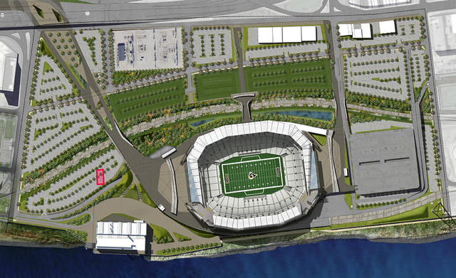
Looking at the most recently released site plan for the stadium, Al's Restaurant is bulldozed for... you guessed it, a surface parking lot. Approximate location of Al's, one block west of the monumental Ashley Street Power Plant, is shown in red.
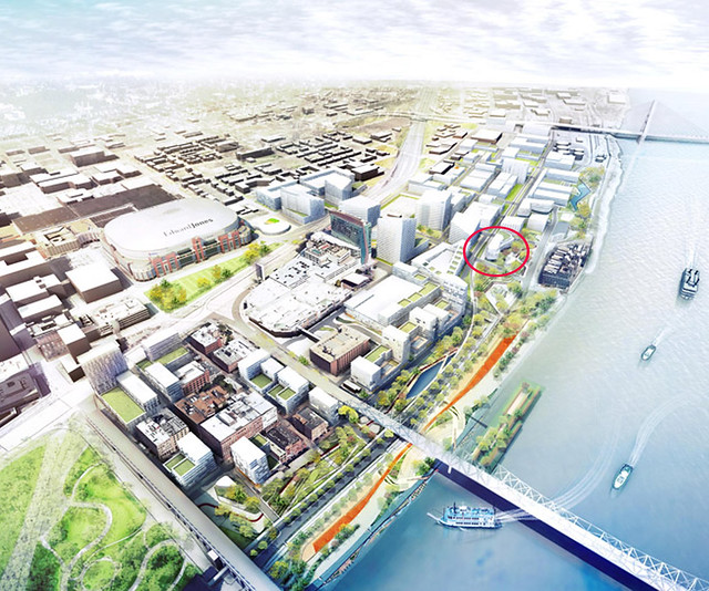 Surprisingly Al's is even missing in the Great Rivers Greenway North Riverfront Open Space and Redevelopment Plan which was previewed in July. The GRG plan is an ambitious well thought out urban plan calling for preservation of historic buildings, new construction residential & office infill and development of active green spaces, but somehow they managed to completely miss Al's. The rendering above appears to show Al's Restaurant overtaken by a 3-4 story jelly bean shaped building west of the historic Ashley Street Power Plant.
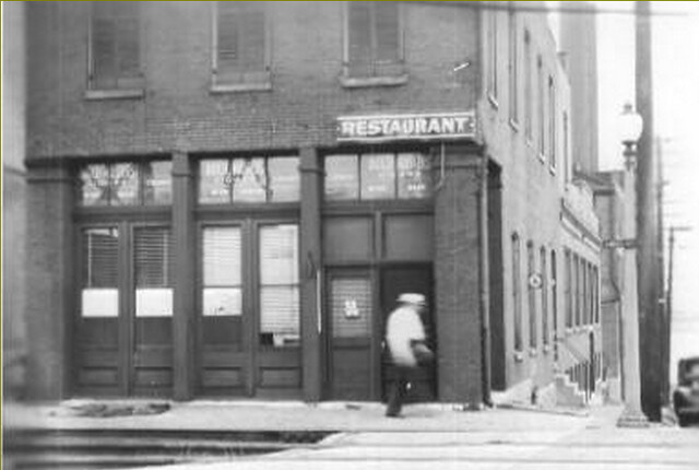
 Admittedly, it is easy to miss Al's, which today from the exterior appears as just another white painted windowless 1-story brick box located at the northeast corner of N. 1st and Biddle Streets. Only the black awnings and understated signage give you any indication that this is something other than another non-descript storage building down by the river. You can easily drive by and not have any clue whats inside.
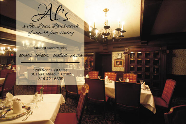 Stepping inside Al's takes you back decades to time of elegance with white linen table cloths, red tufted leather chairs, dark wood paneled walls and brass chandeliers. In classic steakhouse fashion, there are not menus. Instead fine cuts of meat are presented on a silver tray for selection. Long known locally as one of the best places for steak, among other national awards and lists, Al's made a CNN top ten list of historic restaurants a few years ago.
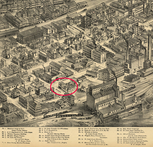 The building that houses Al's Restaurant has been around since before Compton & Dry created their iconic 3D map of our city in 1876 housing a combination saloon and sugar exchange.
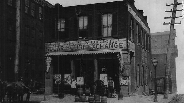 This pre-1900 photo shows the front of the building on 1st Street. The towering St. Louis Grain Elevator on the riverfront which would be replaced by the Ashley Street Power Plant can be seen in the background. Albert Barroni opened his restaurant here in 1925 first serving egg sandwiches to the local factory and railroad workers in the then bustling industrial district. As industry moved on, Albert Jr. refocused the establishment to sophisticated fine dining.
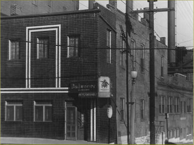 At some point the front of the building received a "modernization" in the form of contrasting light and dark glazed tile cladding. Later, the 2nd floor was removed and windows were bricked-in giving way to its appearance today. Most of the context of Al's Restaurant visible in the detailed axonometric drawing above has disappeared, being replaced by gravel lots and asphalt but Al's has remained still serving fine food night after night. With your help and some simple refinement by the planners, Al's might still be serving St. Louis for another 90+ years.
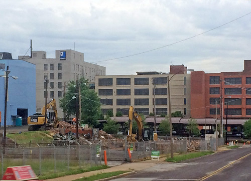
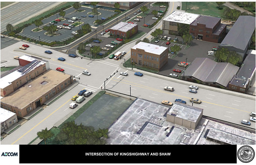
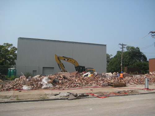 Kingshighway will close today for reconstruction of the viaduct between Shaw Blvd. & Vandeventer, but the City's Board of Public Service has already been busy spending your tax dollars to demolish a three story brick warehouse as part of an ill-conceived plan to re-align Shaw Blvd. at Kingshighway (which makes sense), but to also keep the present Shaw Blvd. (which doesn't make sense). By doing so, O'Connell's Pub loses some of its existing parking lot, so the City is demolishing the warehouse to pave additional spots to make up for the lost parking. The warehouse building was in good condition and was occupied until it was purchased by the City.
Next STL brought this plan to light over 3 years ago, and showed how eliminating the existing Shaw Blvd. would regain the lost parking spaces and avoid a needless demolition. It is apparent that the City has not made any major changes and is moving forward. A demolition permit was issued on June 23rd and as of yesterday, the building was already gone (photo above).
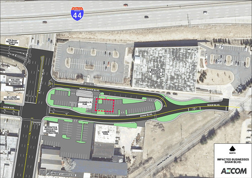 The plan above shows how Shaw Blvd. will split with two separate roadways that will intersect Kingshighway. Eliminating the original roadway and adding an access drive or a short spur road providing access to the Botanical Garden lot off shaw north of O'Connell's would have provided space for additional parking spaces and would have allowed the warehouse building (outlined in red) to remain. See Next STL's plan for this here.
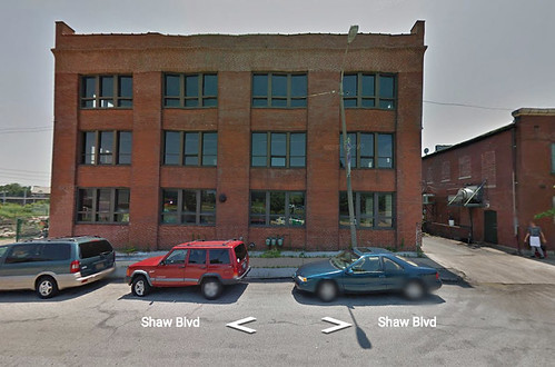 The warehouse building had been constructed in 1911 as an expansion of the Banner Iron works complex, which had been established on Shaw on property adjacent to the rail crossing to the east in 1901. Banner Iron Works was a foundry and fabricator of cast iron and steel for the construction business, producing cast iron storefronts and other building components, manhole covers, street signal boxes as well as the iconic gas lamp poles that were installed in many areas of St. Louis. One of these poles was recently exhibited in Missouri History Museum's St. Louis 250/250 exhibit. Banner also designed and fabricated the structural frame of the Admiral river boat, which was destroyed for scrap in 2011.
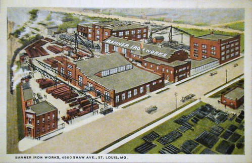 This postcard shows the entire Banner Iron Works complex with the recently demolished warehouse in the upper right corner. The company closed in 1986, and most of the complex east of the warehouse had already been demolished. The large three story building at the top center of the postcard is still in use by Lunar tool.
 A rendering of the flawed dual Shaw Boulevards, which not only resulted in demolition of the Banner Iron Works warehouse, but is sure to cause confusion for drivers.
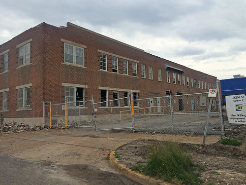
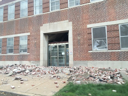
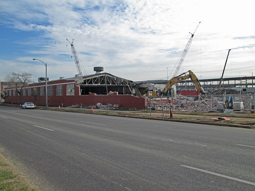
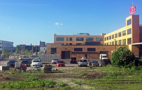 This week demolition began on the Brauer Supply building at the southeast corner of Forest Park and Boyle in the Cortex district. A gaping hole is visible at the back of the Brauer building to the left and beyond the rehabilitated @4240 building which opened last summer and has already and recently achieved 90% occupancy.
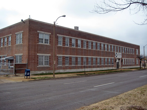
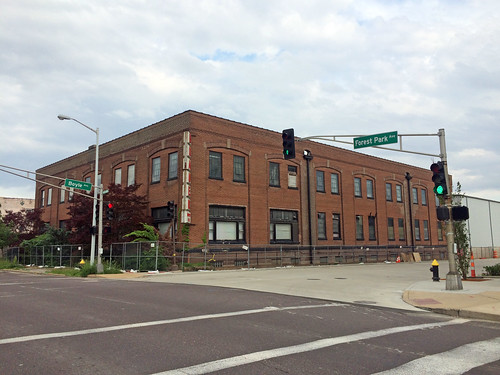 A view of the Brauer Supply building from Forest Park. Back in April 2011 the St. Louis Preservation Board was to consider three buildings for listing on the National Register: the @4240 building, built as a SWB Telephone Distribution House, the Crescent building on Duncan west of Boyle, built as a printing facility for the St. Louis Post Dispatch, and the Brauer Supply building, which was constructed in 1919 as the J.I. Case Threshing Machine Company Branch House. This presumably was a sign that the three buildings would be rehabilitated using historic tax credits to serve new functions.
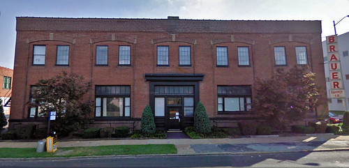 Unfortunately the Brauer Supply building was not listed and no listing seems to be present for the Crescent building either, although I have heard people say that it is earmarked for renovation.
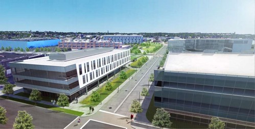 Instead of renovation, the Brauer Supply building will be demolished for a new 3-story 60,000 s.f. building to be built by Cortex. The new building cuts and pastes designs from the Cortex I building across Boyle that opened in 2006 and the BJC Commons building to the south that opened in 2013. So much for innovative architecture in an innovation district!
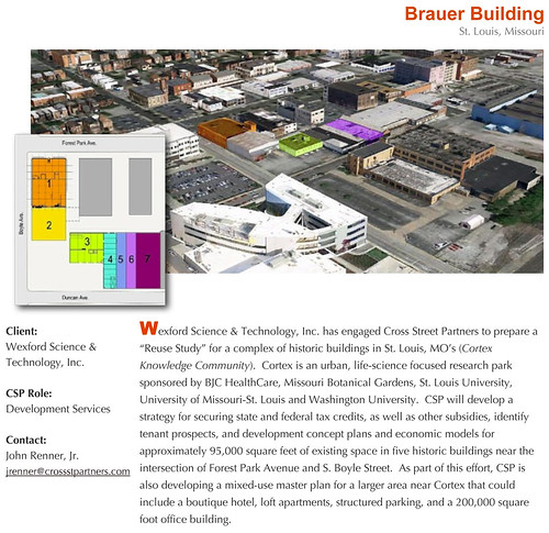 According to a story by Maria Altman of St. Louis Public Radio, there where no less than two assessments of the Brauer Building with intentions of rehabilitation, but the decision to demolish and build new apparently came down to costs. Above is a reuse study completed by Cross Street Partners which included concept plans for rehabilitation of the Brauer building and a series of adjacent one-story historic buildings on the north side of Duncan with a total of 95,000 s.f. of renovated space.
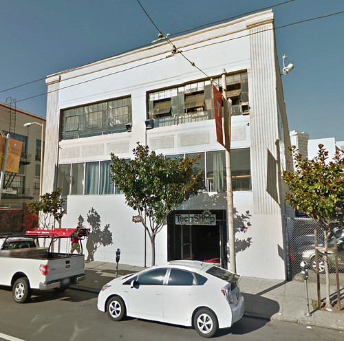 I find it odd that Cortex's CEO stated in the STL Public Radio story said that the Brauer Building would have been difficult to make work for Tech Shop, who will be an anchor tenant in the new building. The Streetview shot above is of Tech Shop's San Francisco location, which is housed in an old warehouse building in the SOMA district that appears to date from the 1920's or 1930's.
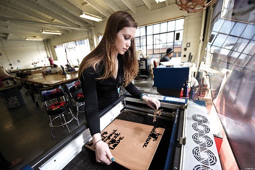 Here is a photo of the interior of the SF Tech Shop from their website.
 In Fargo, North Dakota another J.I. Case Threshing Machine Company Branch House with almost the exact same footprint of the Brauer building continues service as an office building. It will soon lose its sister in St. Louis.
 Demolition has begun on the Laclede Gas field office building on Forest Park Boulevard west of Vandeventer. Clearance of the 2-story building building just several feet from the sidewalk along Forest Park will complete the suburbanization of the Ikea site, leaving only the big new blue box that will sit 500 feet back behind a sea of surface parking.
 A view along Forest Park from earlier this year. The building, according to City records was constructed in 1936, and exhibits spare stream line detailing common for the period.
 This demolition is less about the loss of the office building and accompanying garage to the west, which was very utilitarian in style, than it is about the loss of an urban character along this stretch of the broad boulevard. Directly across the street a large grassy field still sits at the northwest corner of Forest Park & Vandeventer where the Welle-Boettler Baking Company complex was needlessly demolished by CORTEX in 2011.
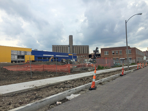 A view of the Ikea site from a point near the corner at Vandeventer.
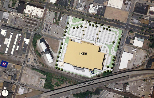 The suburban style Ikea site plan with parking in front and a three lane access road running parallel to Forest Park and Vandeventer. Like most Ikea stores, the new St. Louis store will also have parking under the building.
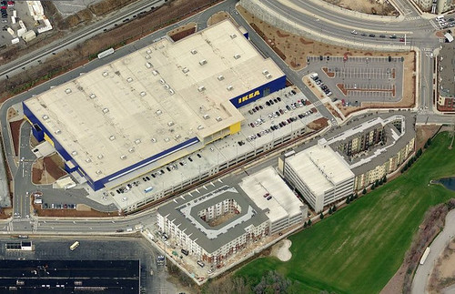 As NextSTL illustrated last year, the Ikea in Atlanta is in similar proximity to the center of the city as ours but has a better plan. Although the site is somewhat less urban due to interruptions of the street grid, the store and garage extending out below are packed onto a much tighter site. Instead of a 3-lane mall style ring road, the city street is fronted on the other side by two new multi-story apartment buildings. The ensemble is a much more urban solution fitting into an urban environment, and would fit entirely on the Forest Park & Vandeventer site.
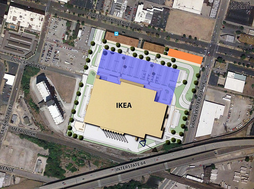 Even if the Ikea St. Louis was not fronted by a large apartment complex, another solution would be to include a row of smaller retail stores along Forest Park Boulevard. Through selective demolition the the front wing of the Laclede Gas offices, which was the same was 60 feet depth as a typical strip retail building, could have housed 10,800 s.f. of retail space. The upper level could have housed the same amount of office space for companies wanting to be in the CORTEX area. Instead of surface parking, an additional parking level would be built in the middle (shown in blue).
 The garage building west of the office structure, which was demolished earlier this year, could have housed an additional 19,600 s.f. of retail stores in 70 foot deep column free space under the large trusses seen above. East of the office building a new retail building could be 18,000 built for additional small stores (shown orange above) or a medium size 20-25,000 s.f. junior anchor could be built.
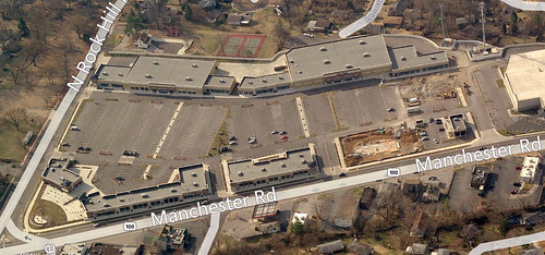 The concept of lining the street with smaller stores is nothing new and a local example was built several years ago at the southwest corner of Manchester and Rock Hill Roads.
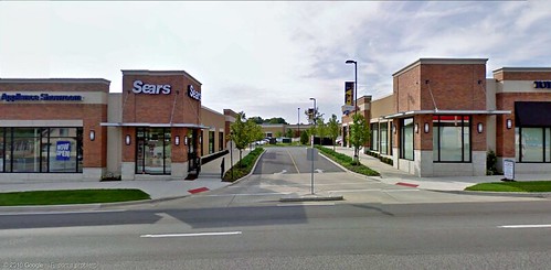 From Manchester Road, the Market at McKnight is an attractive window lined pedestrian friendly experience. Yes, this corner of suburban Rock Hill is more urban than Midtown's Ikea site. Oh wait, they tore down a historic church for a gas station right across the street.
Like everyone else, I'm thrilled an Ikea is about to open in the center of the City of St. Louis, but it could be much more. Additional development could always happen in the future on the parking lot in front of Ikea as was shown on an old CORTEX master plan, but what would be their incentive since they own the entire site?
The site to the west bounded by the Ikea, the grain elevator, Sarah Street and Forest Park Boulevard is owned by CORTEX, who put out an RFP last year for a mixed use development. Hopefully this site will be fully built-up and not be a continuation of the suburban Ikea model.
 Probably the only parking lot in the region lit entirely by gas lamps is also gone.