

This week I was checking out an aerial photo of the neighborhood near a potential project that we are working on in the soon to be listed National Register District along Martin Luther King Drive in the Wellston Loop area (the district is actually in the City of St. Louis extending from Clara west to the City limit). A house at the corner of Wells Avenue and Amherst Terrace between Hamilton and Hodiamont stood out to me because of its form and the shape of its lot. The house is located a block south of the former JC Penny Building on Martin Luther King, which is one of the City's few remaining examples of the International Style. The large paved lot across Wells from the homes site served the now vacant JC Penny.

I took a look at Geo St. Louis, and they have two images of the house at 5942 Wells, which I quickly discovered had been demolished. The house was frame construction, but had been covered in asphalt shingle panels with a faux brick finish, which must have been someone's lame attempt to make the house "fit-in" with its predominantly brick neighbors.
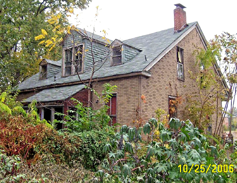
The home was likely one of the first in the area as a 1909 Sanborn map shows the house on a large oddly shaped piece of land with two other frame houses on the same parcel. Most of the block remained un-platted at the time with a large parcel just to the south containing only a frame shed, indicating that this may have been the remains of a farm. According to the City's property database, the home came into the possession of the LRA in 1998, and despite appearing to be in decent condition from the exterior in the 2006 photos, it was demolished in February 2007.
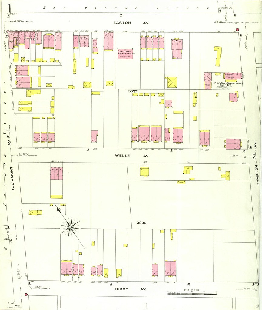
1909 Sanborn map. 5942 Wells is right below "AV"
No comments:
Post a Comment