

For this post we venture beyond the City limit to the nearby inner suburbs of Ladue and the western portion of Richmond Heights to view not the loss of a historic building in an urban context, but that of fragments of an aging transportation infrastructure undergoing total replacement. The portion of Highway 40 between Brentwood Boulevard and Spoede Road dates from 1936 to 1946. While it was no Merritt Parkway, many of the bridges constructed along this stretch of highway reflect the streamlined style that was applied to almost anything having to do with movement. The photo above is from a series of old photos available for view on thenewi64.org history page.
 This section of roadway was a relic from another era, when cars traveled at a then considered speedy 45-50 mph. It was built with an almost parkway like feel, with two lanes each direction separated by a grassy median. This parkway like feel was, and still is to this day augmented by the fact that it bisects a community that by choice has preserved an almost rural feel by shunning office parks, mega-strip malls, and cookie cutter subdivisions that fill much of the modern suburban landscape.
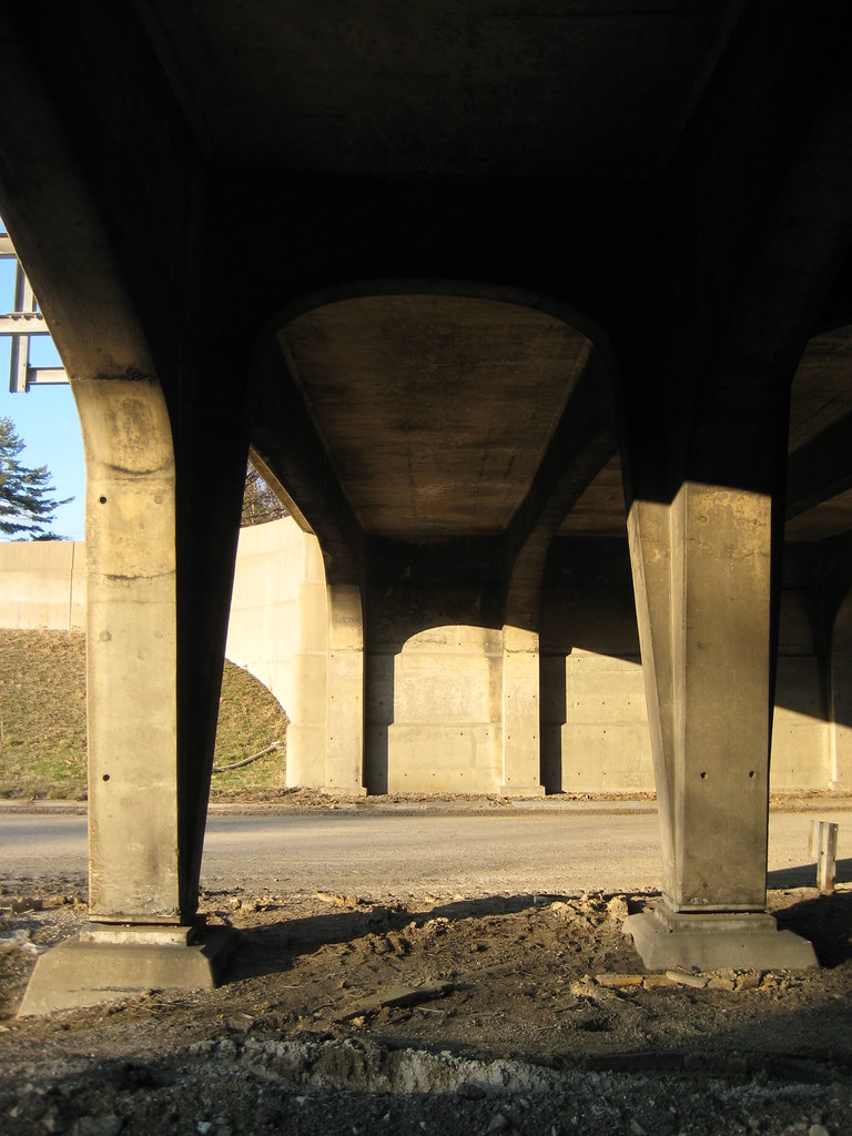
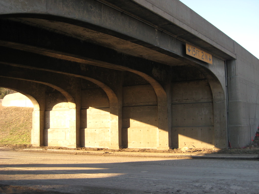
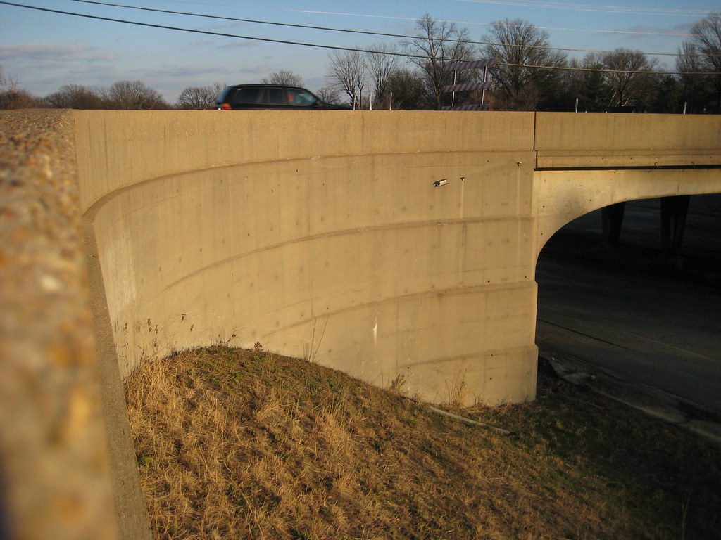 Without a doubt the most interesting surviving structures were the overpasses at McKnight and McCutcheon. The McKnight bridge was a wonderful expression of streamlined modern with its curving stepped embankments.
 The bridge at McCutcheon was a bit more fanciful with the lines of its embankments fanning out from the earth. There are more art deco influences in this bridge with its decorative pilasters flanking the span and a medallion at the graceful center columns.
 Photographing the bridges was an almost surreal experience. For the first time in my life, I was walking down the middle of the highway! The bridges that I had known and appreciated since I was a child growing up nearby could now be fully enjoyed at a pace a bit slower than 70 mph. Details that I had never been able to see but for a nano second such as the gracefulness of the arches running perpendicular between the center columns or the way the lines of the embankments at McKnight continued through under the spans could now be captured.
 I was not alone in my fascination. On a sunny but very chilly Sunday in mid-January there were several people out. Some like me were taking photographs, while others were simply out running or walking the dog. It was as if people had taken over the former highway as a a new recreation area or a linear park.
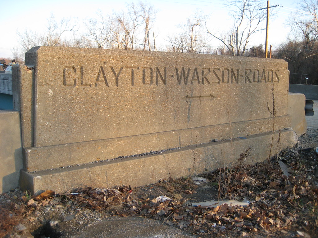 Location marker cast into each end of the overpass span at the median
 A concrete sculpture commemorating the trans-Atlantic flight of Charles Lindbergh once graced the bridge over Lindbergh Boulevard. It was destroyed many years ago when the median in this section was filled with pavement. (photo from thenewi64.org)
The temporary loss of a highway that played a major role in the decentralization of the City of St. Louis is certainly nothing to mourn, in fact my prediction that the ridiculously over hyped closure would be a non-event instead of the predicted doomsday have come to fruition. The fact that people have easily adjusted, and a large percentage have switched to nearby surface roads as opposed to heading to 70 or 44 leads me to believe that Steve Patterson's concept of replacing 40 with a boulevard including mass transit instead of an over-engineered high speed freeway might have actually been feasible. What is worth mourning is the loss of structures designed with a human hand from an era when good design was a standard feature of public infrastructure. The replacement bridges will be basic utilitarian structures. Today MoDot's idea of "good design" is some black iron fencing and some cutsie neo-historic lamp posts (click here to see a really lame rendering from their web site). More photos can be seen here on Flickr.
3 comments:
Great post. Outside of the Clayton-Warson marker, which I've always found kind of interesting, I've never really stopped to view these structures from an architectural standpoint - Cool.
I hope that the span of highway between Lindbergh and McCutcheon/Brentwood will retain some of its natural scenery, but I have a feeling it's going to be lined with those sound barrier walls instead.
Brian, you are absolutely correct. I finally checked MoDot's website and indeed most of the stretch of the new highway from Lindbergh to Brentwood will have 12-18 foot tall sound walls on both sides, which will effectively obliterate any remaining scenic appeal of the roadway.
Here is a link to MoDot's page that shows exactly where the walls will go: http://www.thenewi64.org/new3_soundwall.jsp
I shall miss those graceful bridges ....
Post a Comment