Now that Centene Corporation has announced that they will build their new 750,000 S.F. headquarters Downtown at Ballpark Village, what will become of Forsyth & Hanley? Opened on September 21st, 1951, The building known most recently as Library Limited (the bookstore I miss terribly) by Harris Armstrong was built as the first suburban branch of Scruggs Vandervoort Barney Department Store. Photo above from the Mercantile Library Collection.
 "Since the automobile has become such a powerful source toward decentralization throughout the country, we feel that the beginning of Vandervoort's suburban store, as part of our modernization and expansion program, is a particularly appropriate feature of our centennial year, which begins a new century for us." These were the words of Frank M. Mayfield, president of Scruggs Vandervoort Barney, Inc. about their new store in Clayton.
Ironically sales at the Clayton branch were so strong that it sucked the life out of their Downtown store that was housed in the Century and Syndicate Trust Buildings. The resulting losses eventually led to the closure of both the Downtown and Clayton stores in 1967.
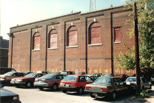
 Before the announcement Sunday of Centene's move Downtown, this sign foretold the buildings doom. Just over 56 years from the day of its opening, the building that was built out of the idea of moving to the suburbs may have been saved (for the moment) by a reversal of the very trend from which it was built.
 Reduced to "Bldg. B". The original canopy extending out to Forsyth was removed years ago by a former owner. Architecturally though, most of the building's features are intact, including the cantilevered sun screen below and the tightly strung awnings that stretch from the parking garage to the rear entrance doors.
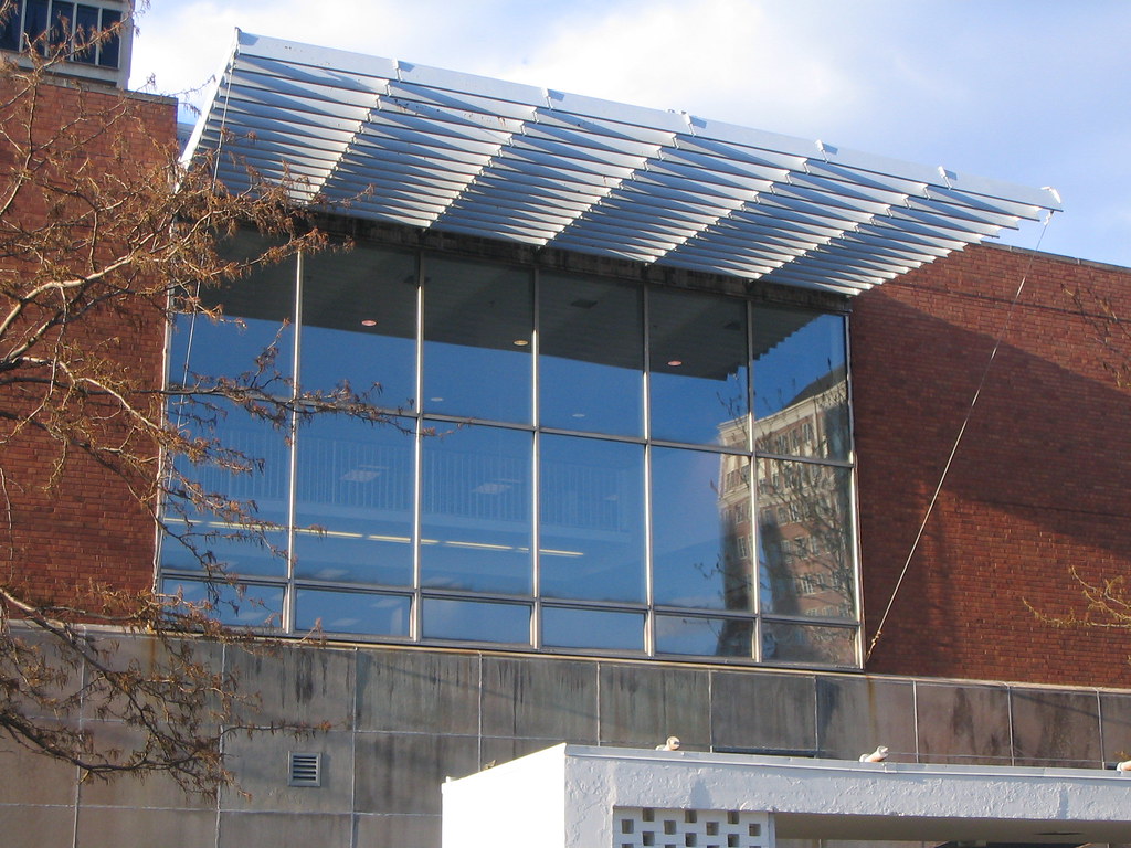 The only problem is that Centene overpaid for the building to the tune of $12 million on the assumption that this cost would be absorbed into the total development cost of the site. Now either Centene has to take a loss on the building, or someone will pay that much for the site with the same thought that the cost will be justified by the redevelopment of the site. Time will tell if someone has the creativity to develop something on the parking garage portion of the site and preserve Harris Armstrong's Forsyth legacy. With Mehlman's proposed development just east, the building (and Forsyth in between) could be poised once again to become a great retail destination.
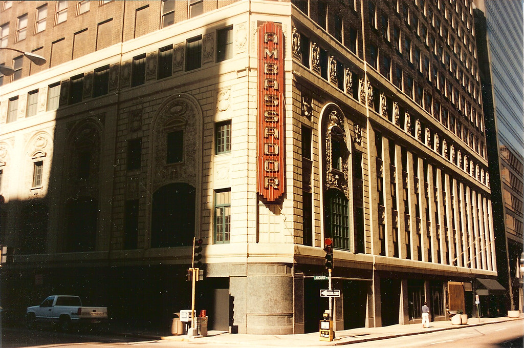 "Today, Mercantile does not have an appropriate entrance to our corporate headquarters". This was the sorry excuse that Ralph Babb, vice-chairman of Mercantile Bank gave at a Heritage and Urban Design Commission hearing in January 1995 to demolish the Ambassador Theater along with a dose of the standard "its too far gone" bullshit. Succumbing to pressure from the "whatever the businesses want" mindset of SLDC director Larry Bushong, the HUDC rolled over and granted the demolition permit.
No "appropriate entrance"!!?? I guess it was not enough that for almost 20 years since its completion in 1976 that the Mercantile Tower had done very well with the landscaped plaza on Washington Avenue complete with its iconic chrome sculpture: Synergism by artists William Severson and Saunders Schultz. Apparently bank officials didn't think this was enough and insisted upon importing a slice of Maryville Office Center into Downtown St. Louis.
 The photo above from PPS shows the tower's entrance plaza on Washington Avenue. Also at right is the columned facade of the Loews State Theater and two other narrow buildings that were demolished in the early 90's to make way the expansion of the convention center (the auditorium of Loews had been demolished almost a decade earlier in 1983).
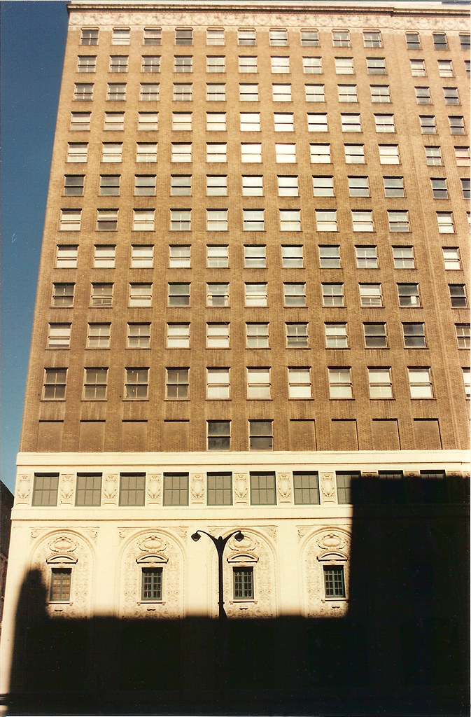 The Ambassador rose 17 stories with eleven office floors above the theater at 7th and Locust Streets. It was completed in 1926 by architects C.W. and George L. Rapp of Chicago. Its opening was promoted as the greatest event in St. Louis since the World's Fair (I wonder how many times that claim was used). In the photo above of the Locust Street facade, above the terra cotta was a row of blank window openings. These concealed the massive trusses that supported the office floors above. More on those below.
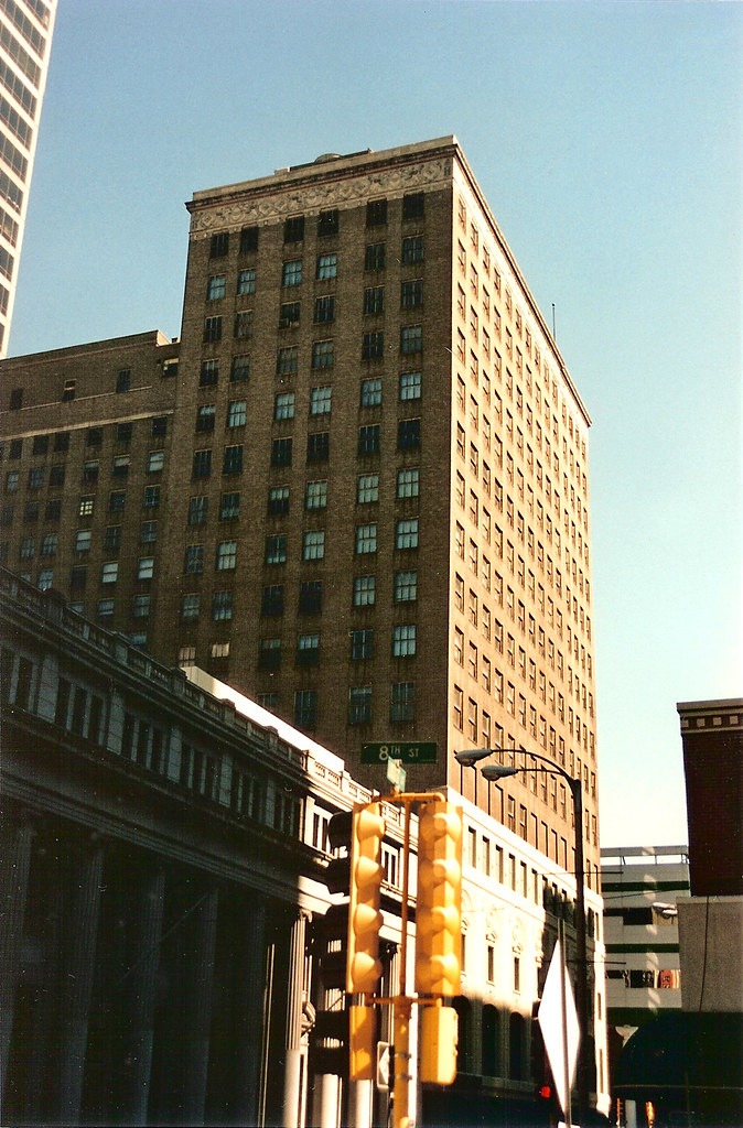 With the context of the three story bank building to the west, the architects chose to wrap the decorative cornice across the entire west elevation of the wing. Typically a cornice would only be wrapped around the corner from the street one bay or less.
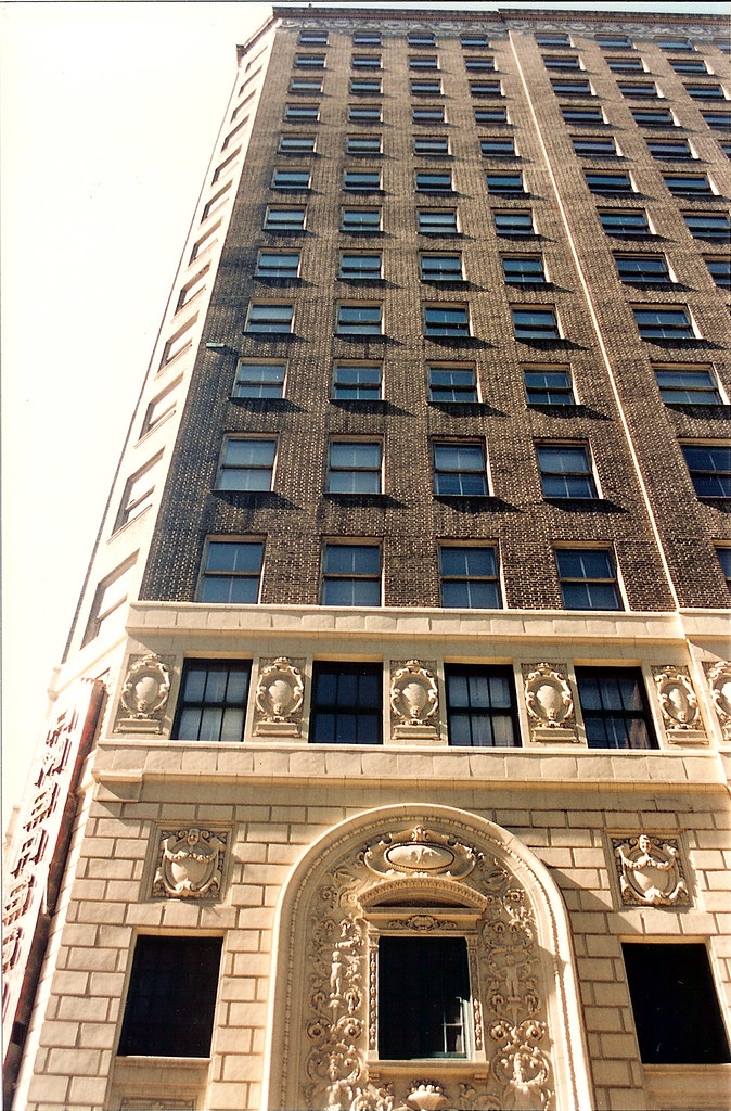 Looking up at the 7th street facade near the corner at Locust
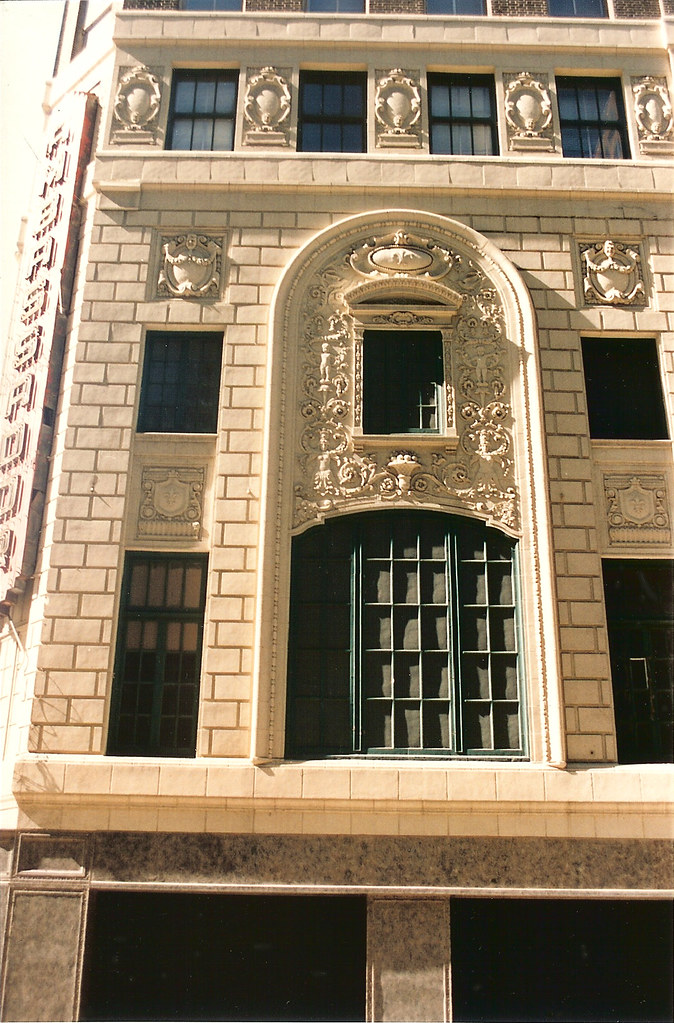 Terra cotta detailing above the theater entrance
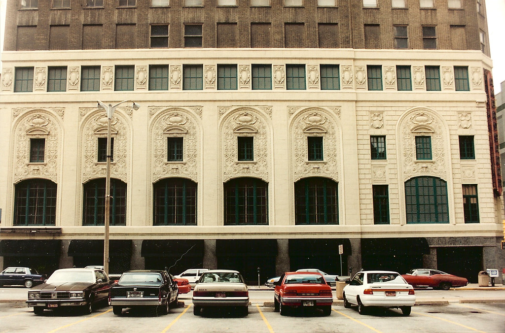 Facade of the theater lobby along Locust Street
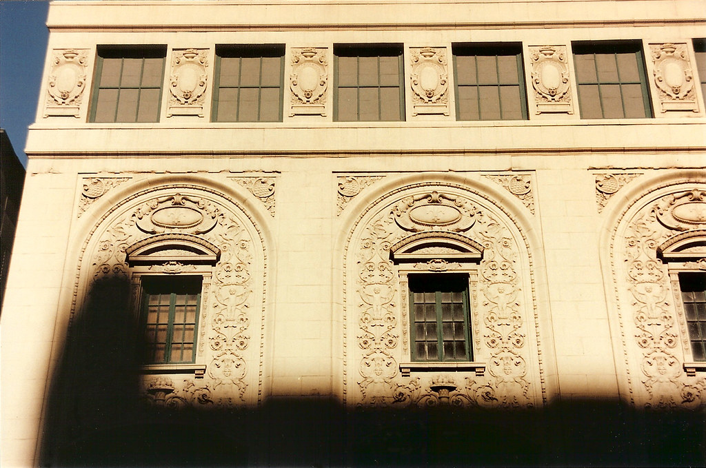 Close-up of the terra cotta along Locust
 The beautiful bronze plaque next to the office entrance on 7th street. The Skouras Brothers financed the construction of the building.
 Griffins, Venetian blinds, and a flag pole along 7th Street
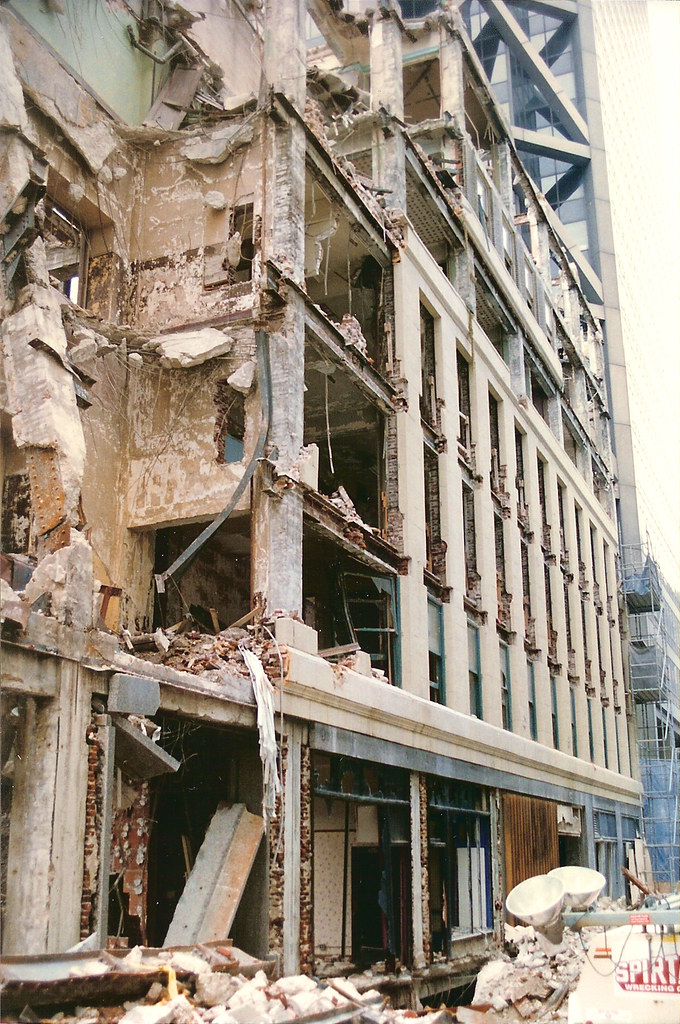 Demolition of the lower floors along 7th Street
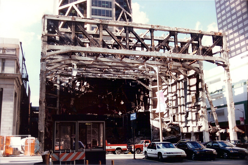 After demolition of the remainder of the building, all that remained was the super-structure including the giant concrete filled trusses, which were apparently a surprise to Spirtas, the demolition contractor.
 The headache ball was unable to make the trusses budge. The building had its last revenge, and a large crane and scaffolding had to be brought in to remove the trusses in pieces.
 The last curtain call
 Seen from the stairwell of the Chemical Building is the glorified driveway that Mercantile installed as their "appropriate entrance".
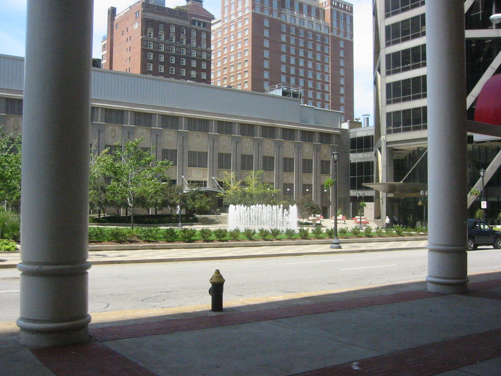 In a token attempt at pleasing anyone with memories of the theater, offices or an appreciation for historic architecture, some terra cotta panels were installed on the back-side of the original bank building. To bad they couldn't even bother to cover up the lovely mechanical shed on the roof.
For more photos of the demolition and several by Toby Weiss of the beautiful interior prior to being stripped, take a look at these pages on Built St. Louis.
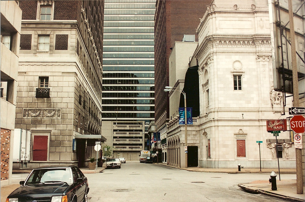
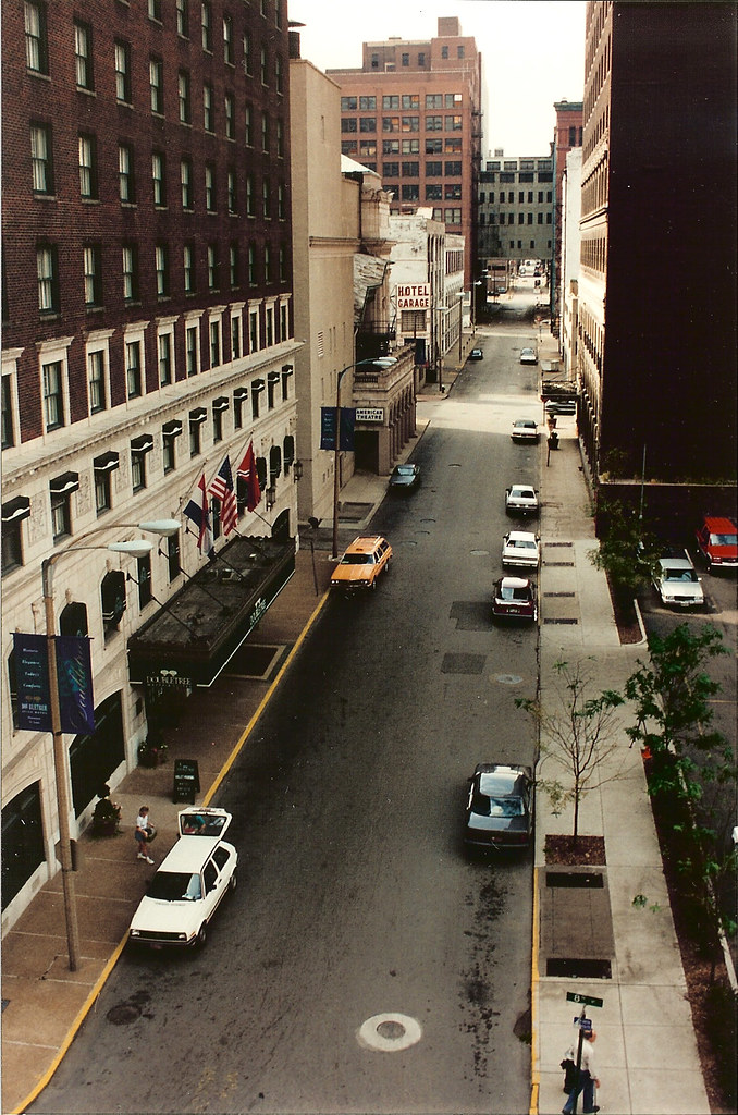 While on the subject of the Merchandise Mart bridges, I just happened to run across these photos of St. Charles Street, the block of which is centered in the photos above and below disappeared several years ago with the construction of the very mediocre ballroom and parking garage block for the Renaissance Hotel. While I was thrilled to see the former Statler rejuvenated as part of the hotel, the new building to the west leaves a lot to be desired, mainly in terms of how it interacts with the street. The retail spaces appear to be an afterthought to plug the left over spaces. Mostly though, the removal of St. Charles Street created a super block that inhibits connectivity in this part of downtown.
 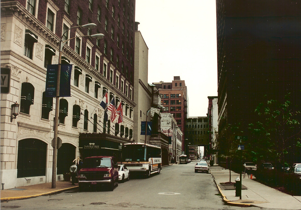 While buildings dictate the character and feel of an area, the streets of a city and their layout play an equal or greater role in how a city feels, its walkability and scale. Standing in the middle of St. Charles in the block where the garage/ballroom now stands, the view east shows how St. Charles Street was first interrupted in the mid 70's with the construction of the Mercantile Bank Building (now US Bank) (more on that block in the next post). The two blocks east of that were taken in the 80's for St. Louis Center, the One Financial Plaza building (formerly Edison Bothers) and another parking garage. The faces of all of these blocks today suffer from a major lack of vitality that is crucial to the success of any urban center with maybe the only exception being 10th Street Italian and the recently opened Time.
 The painting above by Alan Brunettin (which I was fortunate enough to acquire at his moving sale) beautifully depicts the warehouses of Chouteau's Landing and the bridges that connect them, or in the case of the train trestle, fly over them. Unfortunately, as buildings downtown get re-developed, the bridges that connected the once multi-building industrial empires are sometimes disappearing due to short sighted thinking.
 Recently this steel bridge between the Elder Shirt Lofts building and the Bogen building was unceremoniously removed. It was one of many bridges that were built in the early part of the last century between factories and warehouses downtown. As operations in the factories grew, bridges were built to connect portions located in adjacent buildings to increase efficiency. As buildings changed hands through the years, typically each building received ownership of half the bridge with the property line running across the middle.
 When the Elder Shirt building was redeveloped several years ago, I suggested using our half of the above bridge either as a private balcony for one of the 5th floor units or as a common space to be shared by the loft owners (the building has no other common outdoor space). The bridge provided interesting urban views in each direction along Lucas Avenue. At the time though since redevelopment of the other building was uncertain, Pyramid's development department did not want to risk improving half the bridge if its future was uncertain, so it was decided to simply close it off for later use. Apparently the developers of the Bogen did not see the potential for re-use, and the Elder Shirt condo association viewed the bridge as a liability, so they agreed to remove the bridge.
 The ends of the large steel girders remained projecting from the Elder Shirt building a few days after removal.
 The opening to the bridge at the rear of the Bogen.
Just a few years ago, a similar situation occurred a few blocks away between the Merchandise Mart and the 10th Street Lofts. In 1912, the giant Rice-Stix Dry Goods wholesale company outgrew the Merchandise Mart on Washington Avenue. An eleven story annex was built across St. Charles Street and the two buildings connected with a four story bridge. In 1920 the building now known as 1015 Locust was built and it too was connected to the Merchandise Mart with a five story bridge. When the 10th street lofts were developed as downtown's first loft condo building in 1999, again, lack of a certain future of the Merchandise Mart and the bridge led to a decision to close off the bridge. When the Merchandise Mart was redeveloped a few years later, through a lack of vision, the new owners, HRI decided they wanted both bridges removed. 10th Street agreed so long as HRI paid for the entire removal including bricking in the openings on the 10th Street building, and thus the bridge was demolished.
 Fortunately, the owners of 1015 Locust wanted no part of the removal scheme, as you see from the photo above, they had been maintaining their half of the west bridge. This bridge remains, and on the Merchandise Mart side, the bridge is used as living space for the adjoining apartments. Ironically, the Mart once hung a banner on the bridge advertising the apartments featuring the bridge.
  The removal of the east bridge between the Mart and 10th Street Lofts above and below
 At the Majestic Stove Lofts, a bridge multistory connecting two buildings has been creatively re-used as balcony space for units in the adjacent buildings (photo from their website).
Just five blocks east of the livery stable currently being demolished on Locust lies an entire block of vacant land. Until August 1995, the southeast quarter of this block bound by the corner of Locust and Ewing (TE Huntley) was occupied by the parish of St. Charles Borromeo. The buildings were originally built in 1867 for S. John's Methodist Church, and they remained until 1901, when they built a new building at Kingshighway and Washington. In 1902, it was sold to the newly created St. Charles Borromeo parish, who occupied until its closure in 1982.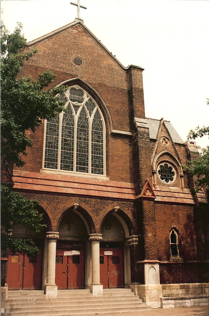 The church sat vacant for many years and was not well secured. I do not recall who owned it at the time, but I do not believe it was the Archdiocese. With its location so close to the Harbor Light center, its probable that it was frequented by homeless squatters. At some point there was a fire in the parish hall which faced Ewing which must have weakened the roof structure. There was a visible sag in the middle of the roof, although the roof was not wide open. The sag in the roof got worse, and one day when I drove by, the entire section of roof had collapsed.
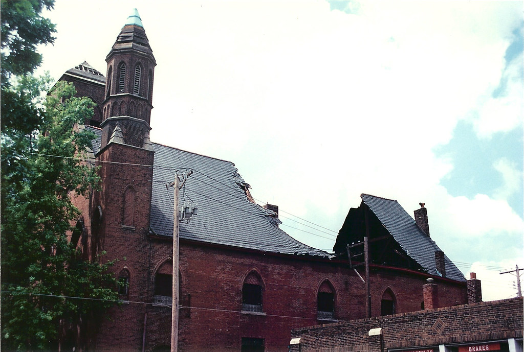 The roof structure consisted of large timber trusses spanning the width of the hall with the roof spanning the other direction between trusses. The failure of a single timber truss led to a collapse of the section of roof on each side. To make matters worse, this was also the section of roof that connected to the sanctuary structure that fronted on Locust. Not long after the roof collapse, the city condemned the building and the entire complex was demolished.
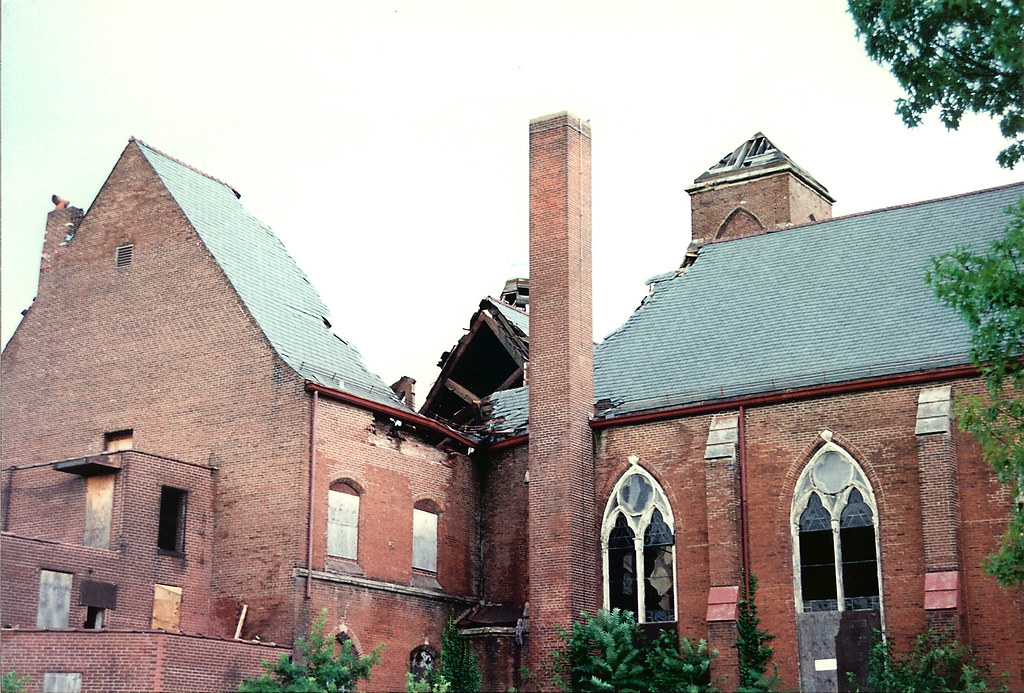 View of the collapse from the southwest. The sanctuary is to the right of the tall chimney. As devestating as the collapse appears, the rest of the building complex was stucturally sound. Given the right owner, even damage like this can be re-built and the building saved.
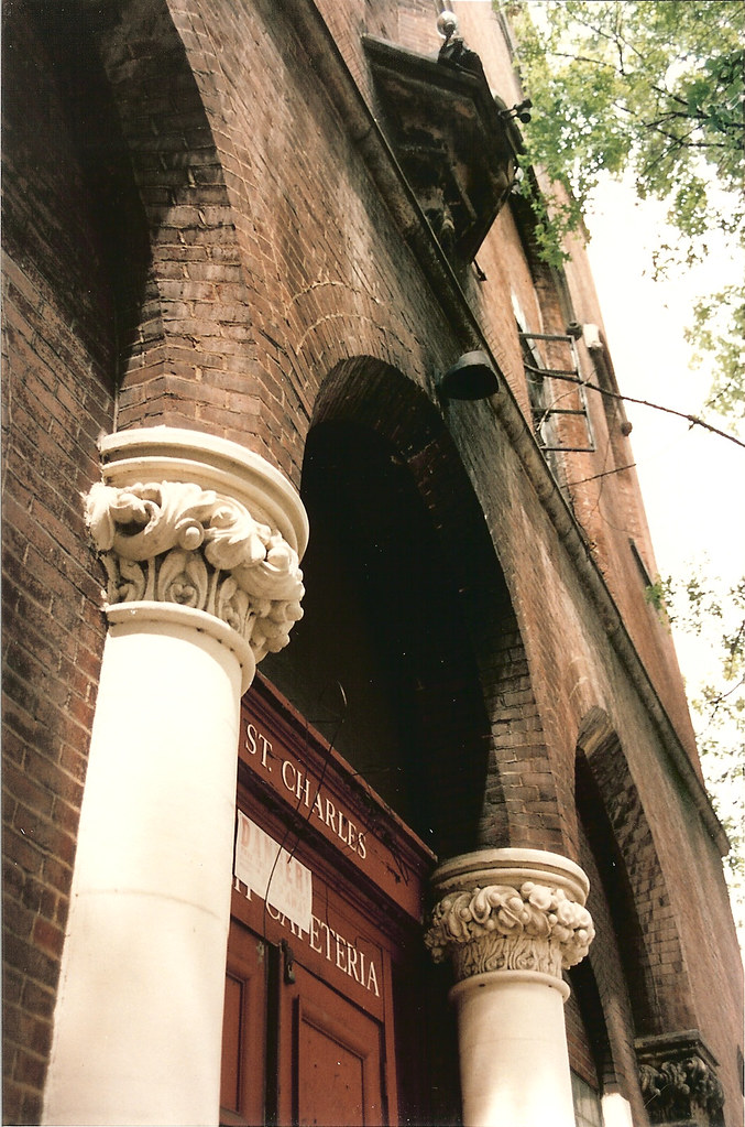 The entrance to the parish hall on Ewing with the condemnation notice tacked on above. The doors were unsecured, allowing me to get some shots inside.
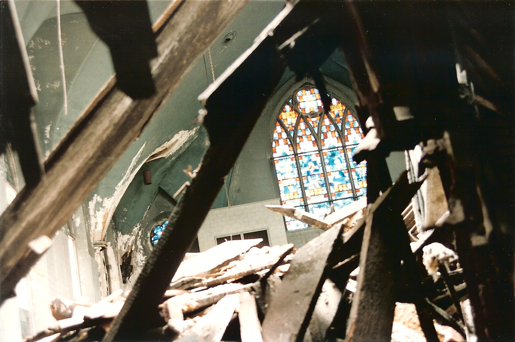 Looking through the wreckage into the sanctuary. The large stained glass window facing Locust is the same one in the first photo.
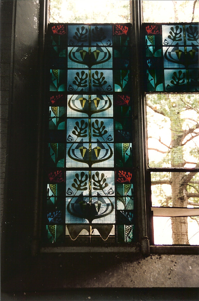 The sanctuary windows had panels of Matisse-like stained glass.
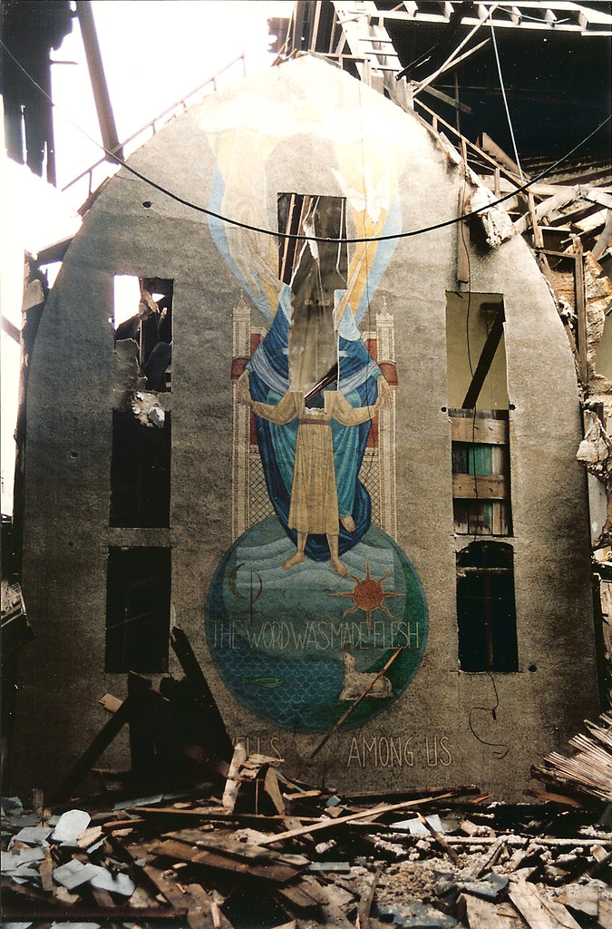 The front wall of the sanctuary, where portions of the large wall paintings had previously been cut-out. Above the wall can be seen the open structure of the parish hall roof and the opening left where the portion had collapsed.

 Now that Centene Corporation has announced that they will build their new 750,000 S.F. headquarters Downtown at Ballpark Village, what will become of Forsyth & Hanley? Opened on September 21st, 1951, The building known most recently as Library Limited (the bookstore I miss terribly) by Harris Armstrong was built as the first suburban branch of Scruggs Vandervoort Barney Department Store. Photo above from the Mercantile Library Collection.