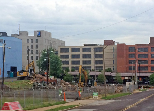
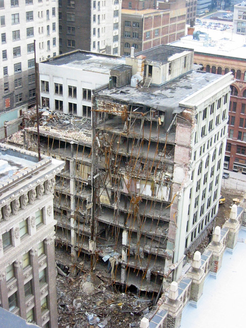
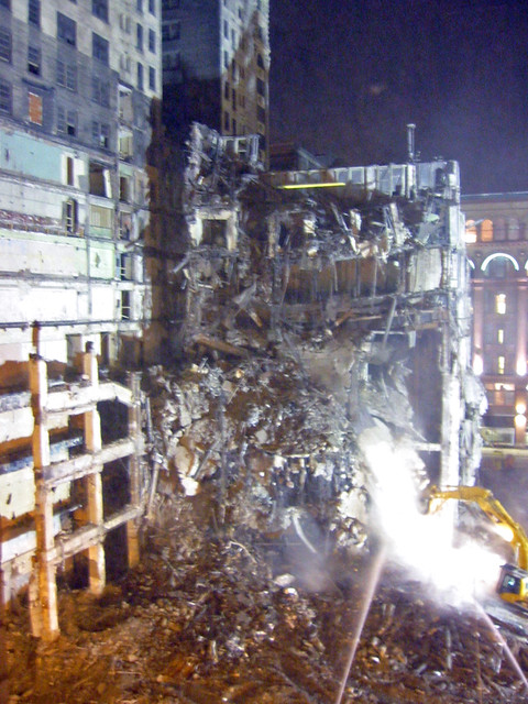
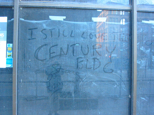
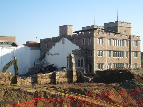
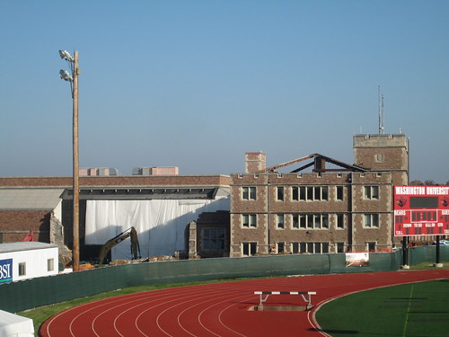
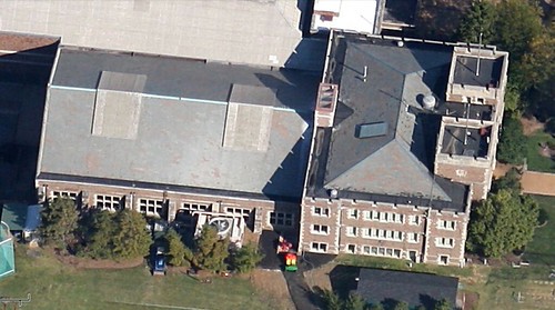
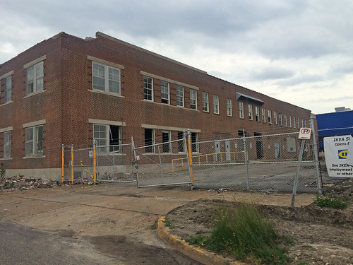
 Demolition has begun on the Laclede Gas field office building on Forest Park Boulevard west of Vandeventer. Clearance of the 2-story building building just several feet from the sidewalk along Forest Park will complete the suburbanization of the Ikea site, leaving only the big new blue box that will sit 500 feet back behind a sea of surface parking.
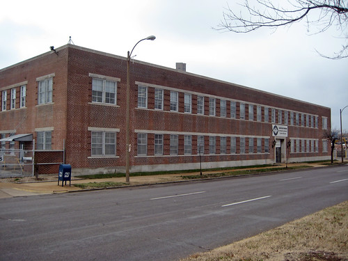 A view along Forest Park from earlier this year. The building, according to City records was constructed in 1936, and exhibits spare stream line detailing common for the period.
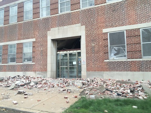 This demolition is less about the loss of the office building and accompanying garage to the west, which was very utilitarian in style, than it is about the loss of an urban character along this stretch of the broad boulevard. Directly across the street a large grassy field still sits at the northwest corner of Forest Park & Vandeventer where the Welle-Boettler Baking Company complex was needlessly demolished by CORTEX in 2011.
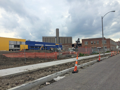 A view of the Ikea site from a point near the corner at Vandeventer.
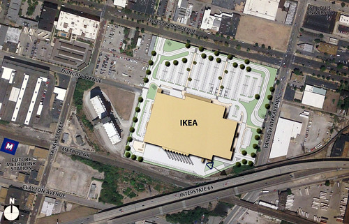 The suburban style Ikea site plan with parking in front and a three lane access road running parallel to Forest Park and Vandeventer. Like most Ikea stores, the new St. Louis store will also have parking under the building.
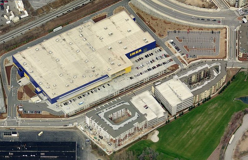 As NextSTL illustrated last year, the Ikea in Atlanta is in similar proximity to the center of the city as ours but has a better plan. Although the site is somewhat less urban due to interruptions of the street grid, the store and garage extending out below are packed onto a much tighter site. Instead of a 3-lane mall style ring road, the city street is fronted on the other side by two new multi-story apartment buildings. The ensemble is a much more urban solution fitting into an urban environment, and would fit entirely on the Forest Park & Vandeventer site.
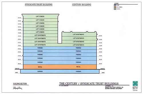
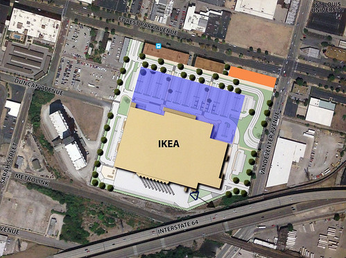 Even if the Ikea St. Louis was not fronted by a large apartment complex, another solution would be to include a row of smaller retail stores along Forest Park Boulevard. Through selective demolition the the front wing of the Laclede Gas offices, which was the same was 60 feet depth as a typical strip retail building, could have housed 10,800 s.f. of retail space. The upper level could have housed the same amount of office space for companies wanting to be in the CORTEX area. Instead of surface parking, an additional parking level would be built in the middle (shown in blue).
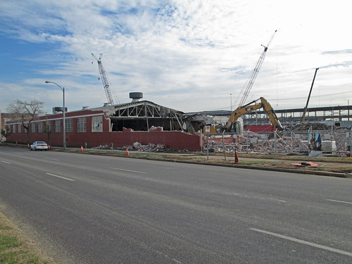 The garage building west of the office structure, which was demolished earlier this year, could have housed an additional 19,600 s.f. of retail stores in 70 foot deep column free space under the large trusses seen above. East of the office building a new retail building could be 18,000 built for additional small stores (shown orange above) or a medium size 20-25,000 s.f. junior anchor could be built.
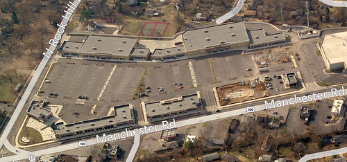 The concept of lining the street with smaller stores is nothing new and a local example was built several years ago at the southwest corner of Manchester and Rock Hill Roads.
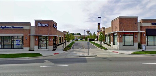 From Manchester Road, the Market at McKnight is an attractive window lined pedestrian friendly experience. Yes, this corner of suburban Rock Hill is more urban than Midtown's Ikea site. Oh wait, they tore down a historic church for a gas station right across the street.
Like everyone else, I'm thrilled an Ikea is about to open in the center of the City of St. Louis, but it could be much more. Additional development could always happen in the future on the parking lot in front of Ikea as was shown on an old CORTEX master plan, but what would be their incentive since they own the entire site?
The site to the west bounded by the Ikea, the grain elevator, Sarah Street and Forest Park Boulevard is owned by CORTEX, who put out an RFP last year for a mixed use development. Hopefully this site will be fully built-up and not be a continuation of the suburban Ikea model.
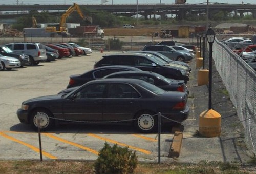 Probably the only parking lot in the region lit entirely by gas lamps is also gone.
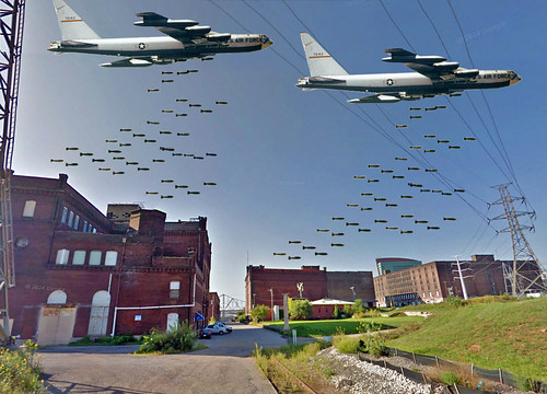 This is the first thing I thought of when I saw the site plan for the proposed new NFL stadium on the North Riverfront announced in early January by David Peacock and Robert Blitz of the St. Louis NFL Task Force. I immediately started thinking of an alternative plan for a new stadium that doesn't require such wanton destruction.
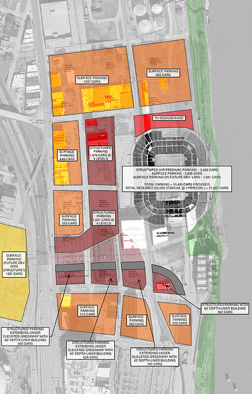
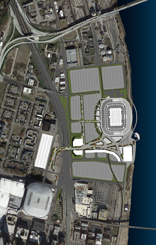 As currently proposed, the stadium and its surrounding sea of surface parking lots, walkways and parking structures would completely wipe out the North Riverfront Industrial Historic District with exception of the Ashley Street Power Plant, which is still used by Trigen to feed the Downtown St. Louis steam loop. Also to be demolished would be the south half of the North Broadway Wholesale & Warehouse Historic District including Shady Jack's Saloon as well as Farmworks, a transitional housing development by Craig Heller and the Cotton Belt Freight Depot, both individual National Register historic properties.
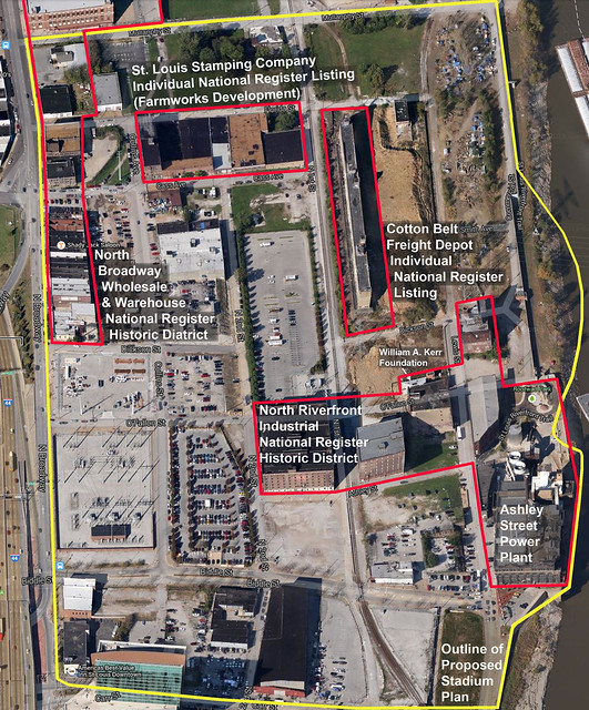 An aerial view of the historic districts and individual National Register historic buildings (outlined in red) that would be demolished by the current stadium proposal (outlined in yellow). Below is a graphic provided by the NFL Task Force that overlays the stadium over the existing context of the North Riverfront. I have highlighted the buildings that would be demolished.
 The alternative plan would build the same open air stadium as proposed by the NFL Task Force, but would simply move it just south of the Ashley Street Power Plant and across 2nd Street from Lumiere Casino and the Four Seasons Hotel. Loading and services would access the stadium via Leonor K Sullivan from the south and Lewis Street from the north under a pedestrian promenade that would extend all the way around the stadium and out over the river. The existing railroad tracks would also be re-routed on a new trestle around the east side of the stadium (the current plan re-routes the tracks west of the stadium).
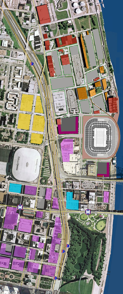
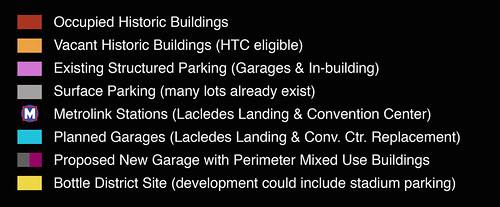 This stadium plan would not only significantly reduce the $90-$110 million estimated budget for demolition, environmental remediation and land purchase, but by moving it 1,600 feet south, would also better integrate the stadium with Downtown St. Louis and Lacledes Landing, positioning it to better take advantage of MetroLink and the plethora of existing parking infrastructure that is already present near the Edward Jones Dome.
The south end of the alternate stadium location would be only about 1,125 feet from the Lacledes Landing MetroLink station, well within the 1/4 mile considered to be a comfortable walk. The current planned location would be 2,725 feet or over over a half mile from the station, which could deter some from taking the train.
The same goes for existing parking infrastructure. Why waste millions of dollars duplicating existing parking spaces when a closer stadium location would put existing garages near the Edward Jones Dome and some garages in the Central Business District, including the large garage at Broadway & Locust and the MX Garage (former St. Louis Centre) nearly as close or closer than the Kiener East & West Garages are to the Dome?
Locating the stadium nearly 1/3 mile farther north would leave garages in the CBD sitting largely empty, not to mention the area restaurants that currently fill with fans before and after football games, and other events at the Dome.
Similar to the present proposal, the alternate plan would include some new structured parking with mixed use buildings built around the perimeter. Locating these farther south as well would allow them to be better utilized on a regular basis, serving Lacledes Landing, Lumiere Place and events at the convention center.
Locating the stadium just east of Lumiere Place could also help jump-start redevelopment of several historic buildings in the North Riverfront Industrial Historic District as well as the Cotton Belt building. Using Historic Tax Credits, these buildings could become residential and office lofts with ground floor spaces for restaurants, bars and other commercial uses... instead of becoming landfill.
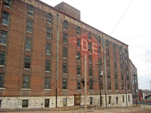 Shapleigh Hardware Warehouse #3 built in 1903 & 1906 fills the entire block between 1st, 2nd, Ashley and O'Fallon Streets. This view showing window detailing similar to some of the Cupples warehouses is along Ashley looking toward the river. Just beyond is a smaller 6 story warehouse built in 1903 for the Beck & Corbitt Iron Company.
 Looking east on O'Fallon Street, the small building on the left was built in 1894 for the Belcher Water Bath Company in 1894 and is now the home of the William A. Kerr Foundation.
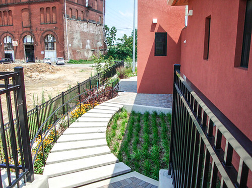 Rehabilitation of the building in 2004 for the foundation achieved LEED Platinum Certification and includes a plethora of green building features including a green roof. It wouldn't be very sustainable to bulldoze it into the ground now, would it? Photo from the Kerr Foundation website.
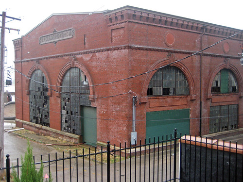 The Laclede Power Company Building was built in 1901 at Lewis and O'Fallon Streets just north of the Ashley Street Power Plant and was later used by Union Electric for electricity generation. More recently, in the mid 2000's, Trailnet proposed renovating the building as a multi-use facility that would include a trailhead for the North Riverfront Trail, a restaurant, bike shop, event and office space. Unfortunately the project was not completed.
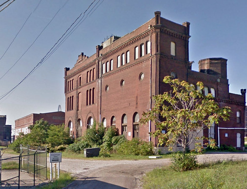 This castle-like building was built in 1900 for the St. Louis Cold Storage Company at 1312-22 Lewis Street. It is one of several buildings in the district that has been proposed for residential rehabilitation in the last dozen years, but still waits.
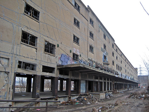 Measuring 750 in length, the massive Cotton Belt Freight Depot Building was built adjacent to the Cotton Belt Line railroad in 1913 entirely of site-formed concrete. Although still vacant, the building has been used for the last dozen years for the annual Artica arts festival.
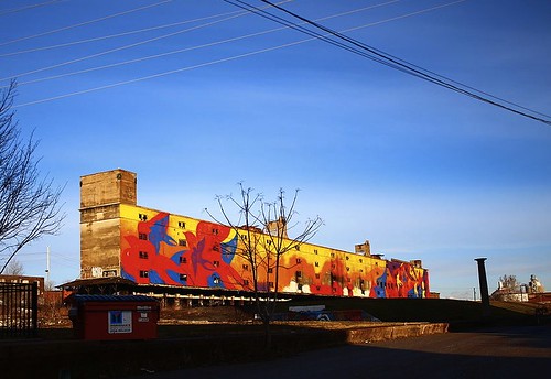 The east side of the Cotten Belt Building was recently transformed into a giant mural called Migrate, which is highly visible to drivers crossing the new Stan Musial Veterans Memorial Bridge.
 Developed by Craig Heller's Loftworks, FarmWorks is a multi-use facility that streches across five buildings along Cass Avenue between 1st Street and Collins Avenue. It includes the St. Louis Stamping Lofts, which provides transitional housing with supportive services and job training, and urban farm with indoor and outdoor growing facilities, a green business incubator focusing on locally grown foods, an educational facility, an anaerobic digester that turns food waste into methane, and a CNG fueling station.
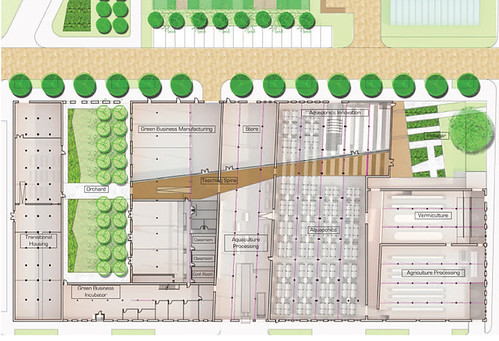 A floor plan rendering of FarmWorks from their website.
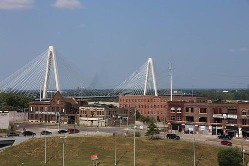 Along north Broadway is a series of buildings that are mostly occupied buildings that comprise the southern half of the North Broadway Wholesale & Warehouse Historic District. Probably the most well known business in this row is Shady Jack's Saloon, which has to be the worlds friendliest biker bar. If you have never been, you should go have their Simple Breakfast, which comes with 2 eggs, bacon, sausage, hash browns, toast and on weekends a complimentary bloody mary, all for $6.95! We cannot lose this for another parking lot! Photo by Paul Sableman
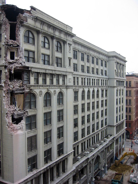
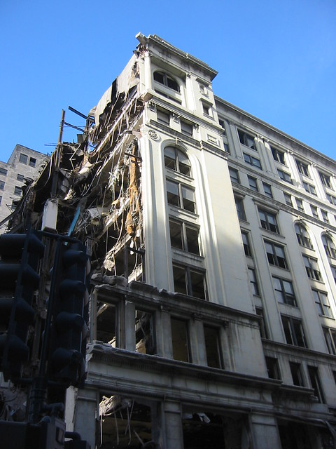
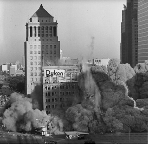 Thirty years ago today at 7:24 am the Buder and International Buildings, which were located on the block bounded by 7th, 8th, Market & Chestnut Streets, were imploded to make way for implementation of the Gateway "Half-Mall" plan. Today the block is occupied by the Gateway One Building on the north half and a plaza/park on the south half.
The photo above is from the St. Louis Post-Dipatch archives. stltoday has a gallery of photos of the implosion and the buildings prior to demolition. For the history of the "Half-Mall" see http://preservationresearch.com/2012/01/the-evolution-of-the-gateway-mall-part-7-pride-and-the-mall/Part 7 of The Evolution of the Gateway Mall by Preservation Research Office.
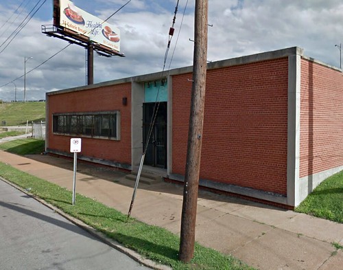 Friday NextSTL posted a great story about the recent rehabilitation of this building at the southeast corner of Clayton Avenue and Sarah Street. What struck me first was Alex Ihnen's initial take on the building prior to it's revival: "Won't survive the CORTEX onslaught, and no one will miss it". He's right. Over the years I've driven through that intersection maybe hundreds of times and the building never jumped out at me as anything too special. I'm glad to see it put back into use and with a surprisingly interesting interior transformation to boot.
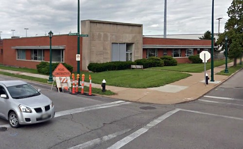 The story made me think about a few other buildings in the area that have disappeared in the last few years without much fanfare, such as this one at the northeast corner of Clayton Avenue and Newstead that was demolished in 2012. The building had a nice limestone entrance element and streamlined eyebrows over the windows, but not enough panache to stand out too much from others of its type and era.
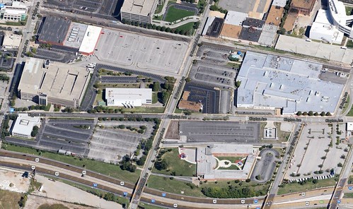 The location is not exactly an urban paradise surrounded by parking lots, a non-descript lab building and a 1-story former factory building. The site opposite on the southwest corner is now home to the soon to be completed Shriners Hospital, but the site plan for the new facility is a typical suburban disaster with the building pushed to the rear corner behind a parking lot so the building can become a billboard along the highway. Also pushed against the highway is the Stix Elementary School which was built on land BJC didn't want so they could put a garage on the site of the original 1921 Classical Revival Stix School on Euclid. The location however is directly between BJC/WU Med and the center of CORTEX, one block from a future Metrolink station and close to Highway 40. All of this would make it a very attractive location for many companies, especially one that has graduated from a nearby biotech incubator and is looking for space of its own.
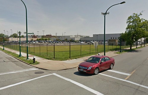 City records show that BJC purchased the building and surrounding parking lot totaling 1.22 acres for $1.45 million in April 2010. In December 2011, they applied for a permit to demolish the building, which was estimated to cost $68,000. Today the building site is a vacant plot of grass surrounded by a chain link fence. Certainly the one story building that was on this site is not the highest and best use for the property assuming the CORTEX district and BJC continue to expand. One has to wonder whether the building could have served an interim use as relatively inexpensive lease space for a growing company until the area surrounding area is built-out and its time to build a larger structure.
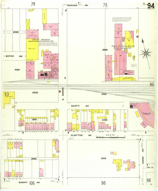
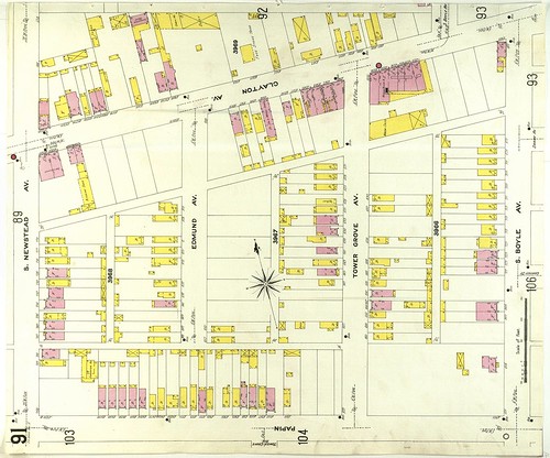 Curious about what was previously on the site before the modern era one story structure, I looked up the 1909 Sanborn map and was surprised to find that the area was a mix of small commercial and residential buildings, a majority of which were built of wood.
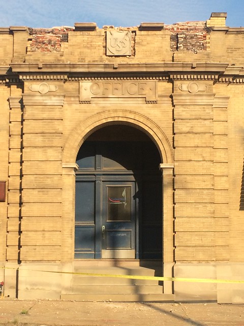
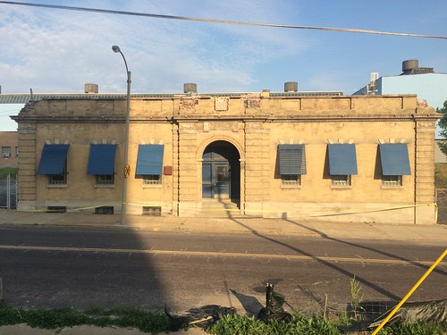
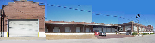 Further east in the 4200 block of Duncan the demolition of this office and freight transfer facility probably dating from the 1920s has less to do with the building than what the CORTEX District will ultimately become. While the eastern office block portion of the building had some appealing aspects, it is safe to say that few saw a great loss when the building was demolished last year.
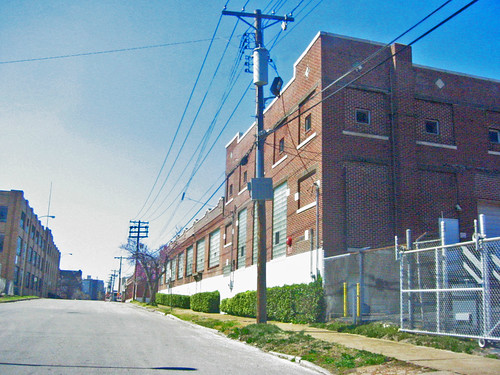 The building was located across the street and just east of the @4240 Building, the historic rehabilitation of the Western Electric - Southwestern Bell Telephone Distribution House, which has been a game changing project for the CORTEX District, proving that historic structures can be rehabilitated for new biotech uses and can become highly desirable. The project by Wexford Science & Technology has been very successful and has attracted among other tenants unexpected new branches of Boeing and Husch Blackwell.
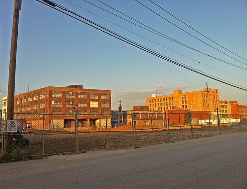 The photo above was taken shortly after the building complex across the street was demolished to make way for a large surface parking lot to serve the @4240 building. Beyond are two large structures fronting on Forest Park Boulevard that currently house storage units and a Salvation Army warehouse. Both are ripe for renewal.
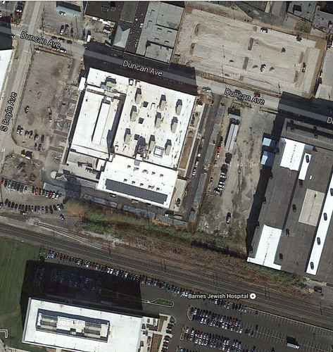 An aerial view of the new parking lot under construction last year in the top right corner of the image. The large white square in the middle is the @4240 Building, which has a smaller amount of surface parking wrapped around the east and south sides. The white rectangle in the bottom left corner is the also recently opened 220,000 s.f. BJC Commons office building that is surrounded on the north and east by a sea of asphalt stretching out of the image almost 750 feet all the way to Sarah Street. The proposed CORTEX Metrolink station will be located between the two buildings.
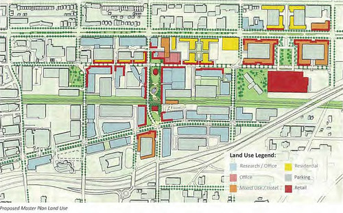 In 2012 the architecture & planning firm Ayers Saint Gross was commissioned to do a master plan for the CORTEX District that showed parking confined to garages and buildings lining the streets forming an urban mixed use innovation district. CORTEX has grown exponentially in the last two years, but is starting to resemble a glorified office park rather than an urban mixed use district. While the planned linear park is currently under construction, the idea of mixed use combined with retail has apparently been thrown out the window with the massive parking lot that will be built in front of IKEA.
For CORTEX to achieve the vision of the master plan they will likely need to do a district wide taxing district to pay for the consolidation of parking and other improvements. Hopefully this is in the works and I understand that these things have to come in phases, but for now, the urban plan views such as the one above are notably absent from the Master Plan page of the CORTEX District's website. Maybe like Peter La Fluer in Dodgeball they have found that if you set goals, you might get disappointed.