Tuesday, November 16, 2010

The Seven year Saga: Sears South Grand

South Grand Sears 01.jpg

The Art Deco Sears store at 3708 South Grand Boulevard opened in 1929 as the company was expanding its retail store presence across the country. The company that had begun in 1888 as a mail order catalog opened its first retail branch in 1925 in Chicago. By March of 1932, despite the onset of the great depression, Sears had an empire of 381 stores across the U.S. Sears followed a prototype of urban neighborhood stores that were 2 to 3 stories in height and easily identifiable by their trademark tower element. Also opened in 1929, just two blocks north was another Art Deco landmark towering over Grand and Gravois, the 10 story South Side National Bank building.
South Grand Sears 02.jpg
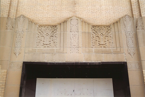
Art Deco stone details over the entrance to the South Grand Sears store.
South Grand Sears 05.jpg

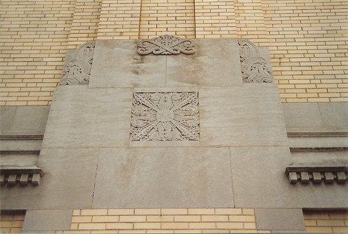
The South Grand Sears had beautiful Art Deco stone detailing. Its sister store built on North Kingshighway between Page and Franklin (now MLK) in 1938, while keeping the same form and proportions as South Grand, exhibits a much more modern look. Gone are the Art Deco details at each column, with the only ornament consisting of fluted limestone flanking the entrances. Horizontal banding of the brick above the entrances and storefront gives sense of streamlined form.
Victor Roberts Bldg. Entrance.png
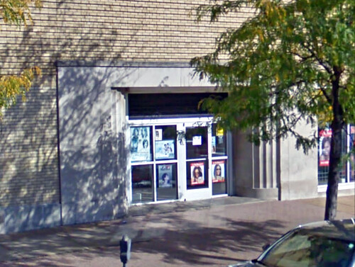
One of two entrances to the former Sears on North Kingshighway.

Sixty years later though, Sears was going through some major adjustments and struggling against competitors. On January 25th 1993 Sears announced the closure of 87 retail stores in 33 states plus the District of Columbia. Included in that closure list was the South Grand Sears store. In the same year Sears also dropped production of its general merchandise catalog due to flagging sales.
South Grand Sears 04.jpg

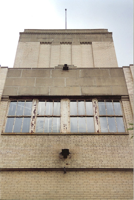
By 1998, the City of St. Louis had put out an RFP for redevelopment of the site of the abandoned store and parking lot occupying a full block between Arkansas and Tennessee Avenues. Development rights went to Pyramid Construction, an up and coming City homebuilder who proposed 26 new homes and a new commercial building along Grand. This of course included demolition of the Sears store building, which was paid for through City funding.
South Grand Sears 03.jpg
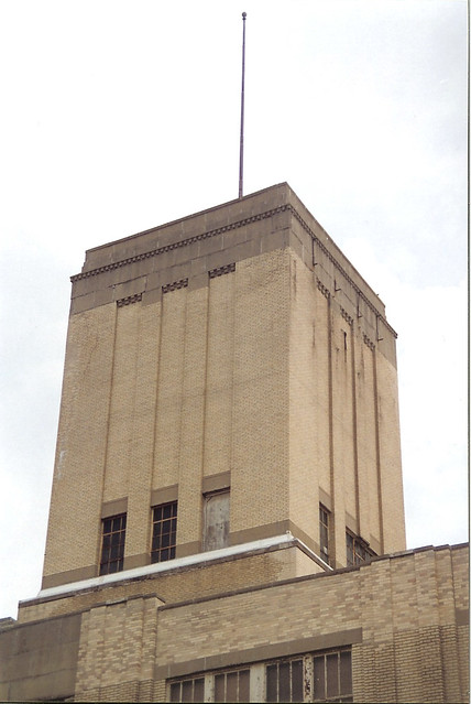
The mis-matched brick over the upper windows indicates that the parapet
was re-built. Given the amount of Art Deco stone detailing below, it is
possible that additional detailing was lost with the repair work.

Even though this was the same year that the Missouri Historic Rehabilitation Tax Credit was established, my understanding is that no thought was given to re-using the Sears building as part of the redevelopment by the City or Pyramid. The re-use potential for the building was very high, as it had only been empty for 5 years, had little to no deterioration over that period and was structurally sound. I started work with Pyramid Architects in July 1999, just one month before the demolition permit was applied for by the residential development arm of Pyramid. When I asked why the building was going to to be demolished, the response was that it was part of the deal with the City.
South Grand Sears 06.jpg
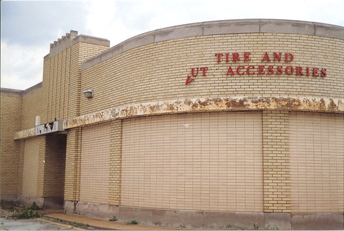
Art Deco design extended to the auto service area at the rear of the store.

Unfortunately since the program was brand new, Pyramid had little experience with the Missouri Historic Rehabilitation Tax Credits. What experience it did have was with small scale residential rehabs in the Shaw neighborhood and a few in Forest Park Southeast. Pyramid was just starting a commercial division that year, and its eyes were focused on empty buildings Downtown. The commercial and residential divisions of Pyramid rarely cross pollenated.
Victor Roberts Building.png
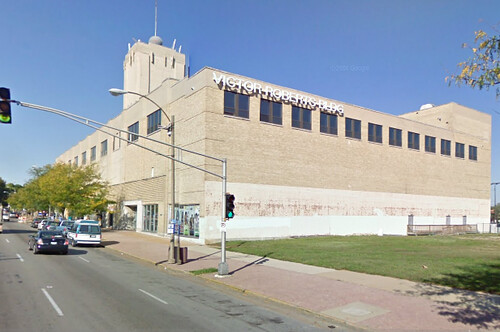
The North Kingshighway Sears saw a much better fate, and was renamed the Victor Roberts Building, the headquarters for the Roberts Companies. While the Roberts Brothers have a mixed history when it comes to historic preservation, their re-use of the Sears building is commendable. The South Grand Sears would have been eligible for listing on the National Register and there is no reason that it should have been demolished. Even without a full blown tax credit gut-rehab, the Roberts Brothers have shown that re-use of the old Sears stores is very possible. At the Roberts building the stainless steel escalators are still used to ferry people from floor to floor.
Lesley University Cambridge Sears Building.jpg
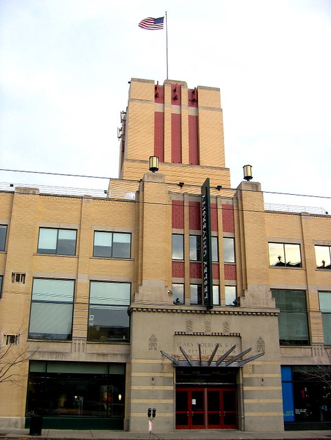
Now part of the campus of Lesley University in Cambridge, Massachusetts, this
is one of many examples of adaptive re-use of former Sears stores across the U.S.

I am not aware that there was much outcry over the demolition of the South Grand Sears store, however it would be an understatement to say that I was out of touch with things happening in this part of the City at that time. If anyone remembers more about this, please comment. By the early months of 2000 demolition of the old Sears store was complete. This however was just the beginning of the story of this property.
Sears South Grand Site.jpg
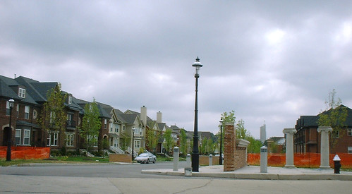
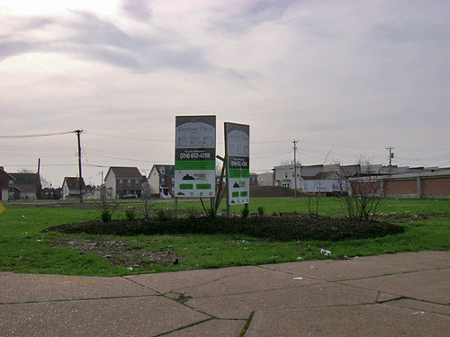
The empty Sears site on Grand with new homes rising beyond.

Later the same year South Side National Bank announced that they intended to sell their building to Walgreens, who intended to demolish the landmark tower for a suburban prototype store. Fortunately in this case, neighborhood activism stopped this demolition, led in large by Jennifer Florida, who would be elected alderman of the 15th Ward in 2001.
Keystone Plaza rendering.jpg
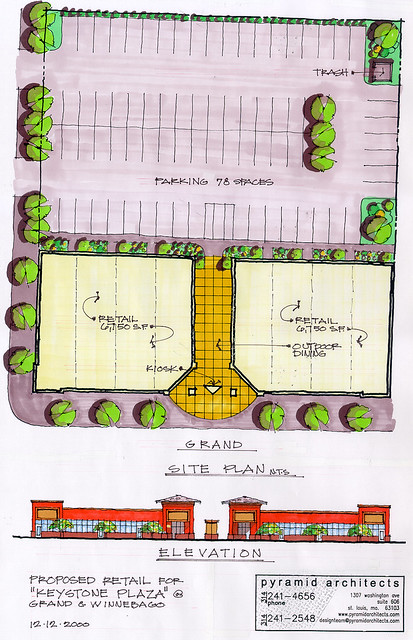
A failed plan for retail development on the former Sears site.

Back at Grand and Winnebago Pyramid was having problems developing the commercial portion of the Sears site. After several years of marketing the site, the former Sears location still sat a vacant. In February 2005 however, a plan emerged that involved Pyramid swapping the Sears site for the existing McDonald's across the street. McDonald's would build a new suburban prototype store on the Sears site, and Pyramid would build a new apartment building for seniors on the McDonald's site.

From the beginning, this plan seemed rife with logic errors. While we had nothing to do with the new McDonald's, Pyramid Architects did work on the senior apartment building. While we made it work, the sloping site where the old McDonald's was located was far from ideal, and the project also hinged on acquiring a non-historic storage building on an adjacent lot. The owner of this building was apparently not very cooperative. Fortunately, the St. Louis urbanist community was not cooperative about the new suburban style McDonald's either.

Alderman Florida who had won wide support of her stance against demolition of the South Side National Bank found that support turn to vehement opposition when she supported Pyramid's McDonald's plan. Opponents held protests, attended meeting, hearings and even attempted to unseat Alderman Florida through a recall election. The topic was covered extensively on Urban Review STL.

Florida T-Shirt
Some who were infuriated by Alderman Jennifer Florida's
support of the McDonald's plan had these shirts printed.

Ultimately in late 2006, those who protested the McDonald's plan won out when Pyramid announced that the land swap was dead and it intended to build the senior apartment building on the former Sears site, thus ending a seven year saga of the fate of a site that should not have been cleared in the first place. The new building got underway in late 2007 and was completed after Pyramid's demise in 2008.

Grand South Senior Apartments 01.jpg
The Grand South Senior Apartments were completed in late 2008. while it is not a bad building, its relatively bland appearance is a far cry from the beauty of the former Sears store. One thing that was done right with this building was the introduction of retails spaces on the ground floor facing Grand.

Grand South Senior Apartments 02.jpg

Friday, October 22, 2010

Hiding in Plain Sight Part 3: Living in Second Life

411 Rendering - Farm & Home Building.jpg
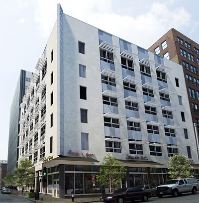
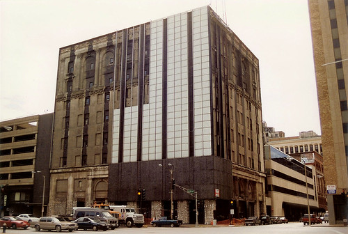
Another example of an early 20th century building Downtown that received a new modern slip cover is the Farm & Home Savings Association at 10th and Locust. The current modern skin was applied to the building in 1954. Farm & Home had purchased the building for its new St. Louis headquarters.

Kinloch Building.jpg
The six story building was originally constructed in the Romanesque style in 1905 as the central exchange for the Kinloch Telephone Company. In 1900 Kinloch had surpassed the rival Bell Telephone Company in number of subscribers, making it St. Louis' largest telephone company at the time. Kinloch sold out to Bell in 1924.

Farm & Home 02.jpg
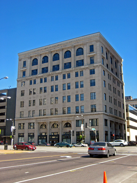
Back to the question of whether a "modernized" building can be restored to its former appearance. The answer as seen in my previous post is: sometimes yes, but in this case, the answer is sometimes no. Both the former Post-Dispatch Building and the 1015 Locust Building are both examples of modernizations that were accomplished by hanging an aluminum and glass curtain wall on the building. As the name implies, the new window and metal panel systems were hung on brackets attached to the masonry structure and like a curtain, there was a small amount of space between the new wall system and the building. In the case of the Post-Dispatch, this allowed the curtain wall to slip over many decorative elements that protruded from the face of the building. This allowed for removal and restoration of the areas that were damaged.

In the case of the Farm & Home Building, a new stone veneer and metal panel system was applied directly to the face of the the original building. This meant that all decorative elements including arches, sills, band courses, cornice, etc. that protruded beyond the face of the field masonry were literally shaved clean off of the building. When Craig Heller bought the building several years ago, he had several of the stone panels removed to investigate the possibility of restoration. As you can see from the photo above, the damage to the brick and terra cotta decoration was extensive. Restoration would have meant a very expensive complete re-construction of all the decorative elements from scratch. Even if the money were available to do this, when damage is this extensive you have to ask yourself "is it worth it?"
Farm & Home 1954 Rendering.jpg
Before the complete modernization of the building, apparently Farm & Home considered a more modest remodeling of the facade. As seen in the rendering above, this would have left
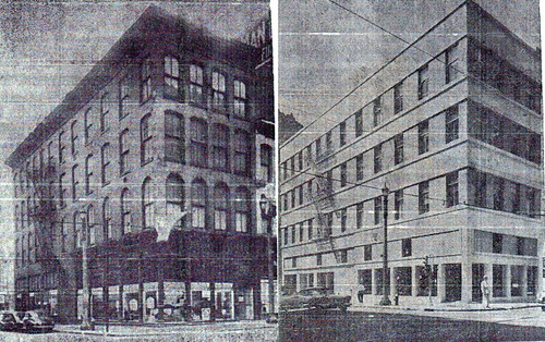
much of the original detail of the building intact. Because the Farm & Home modernization had been completed in the mid-1950's, the new skin was able to be considered to have achieved enough significance in the building's history that it was listed on the National Register with the modern facade. The original Kinloch Building photo, rendering above and three side by sides below are all from the building's nomination.

6th & Olive slip cover.jpg
After World War 2, there was a wave of building modernizations in Downtown St. Louis as owners wanted to both "update" the look of their properties and compete with new construction. The building above was at 6th & Olive.

Dunn's 526 Pine Street.jpg
Another modernization above at 526 Pine Street and below at 1100 Olive.

Conroy Building 1100 Olive.jpg
All three of these "before and after" examples have since been demolished.

Merc Library sm.JPG
Further east at Broadway and Locust is another example of a prominent building that was modernized in the mid-1950's was the Mercantile Library Building. St. Louis' oldest cultural institution, the Mercantile Library was founded in 1846 and is the oldest continually operating library west of the Mississippi. In 1854 the Mercantile Library built its first building at Broadway and Locust then in 1887 began construction of a larger six story building on the same site which was dedicated in 1889.

Mercantile Library Building 2010.jpg
In 1955 the building received a modernization very similar to that of the Farm & Home Building. A granite base was applied to the first floor, limestone veneer wrapped its midsection, and finally red brick was applied to the 6th floor and a severely truncated parapet compared to that originally built. The modernization also included a large new addition to the west of the original building as well as the incorporation of a neighboring building to the south an another facing 6th Street to the west.

First Nat Bank Merc Lib Bldg-1923.jpg
An old advertisement fro marble ant tile shows the opulent interior of the First National Bank of St. Louis which was a main first floor tenant. An image from the Missouri History Museum shows the buildings exterior covered in patriotic bunting on the bank's opening day, July 7, 1919. Prior to construction of the Century Building, Scruggs Vandervoort Barney had also been an early tenant.
First National Bank Interior.jpg
This is all that is left of that interior today, although much of the original interior was probably gutted and covered over during the buildings expansion and modernization in 1955.

IMG_3937a.jpg
A photo shows how the large arched windows on the second and fifth floors were partially filled-in during the modernization. Unfortunately the method of attachment of the stone panels here at the Mercantile Library was the same as that of the Farm & Home. All of the decorative features were shaved off to give a clean flat surface for hanging the new stone. Pyramid determined that even if we had wanted to restore the exterior that because the building had lost so much of its original fabric both on the exterior and interior, including almost complete removal of the south and west walls during expansion, that the original 1889 building would not be eligible for listing on the National Register.

Mercantile Library Interior.jpg
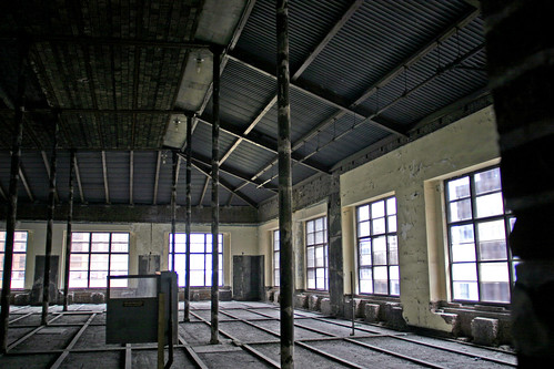
A century after it erected its fortress of knowledge, the Mercantile Library found itself an aging institution with dwindling resources. The library was private and relied on memberships and contributions to sustain itself. With a glut of new office space in Downtown St. Louis after the 1980's building boom, the library also found itself almost the only occupant of its now 250,000 square foot building. Instead of closing its doors, in 1998 the Library made the decision to move to the University of Missouri St. Louis campus. Gone is the once opulent sixth floor reading room and the mezzanine library stacks. Like the Farm & Home, the Mercantile Library is eligible for listing on the National Register as a modern building. With this and a now a blank canvas inside, the building is ready to live its next life when the economy is ready.

Tuesday, October 12, 2010

Hiding in Plain Sight Part 2: Unmasked

Post-Dispatch unmasked 01.jpg
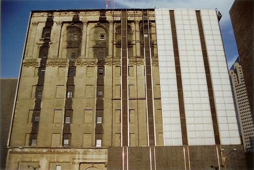
Comments on my previous post about the building at the northeast corner of Tucker and Chouteau inspired me to find some photos I took of the former Post-Dispatch Building several blocks north at Tucker and Olive. Many of you probably remember this dramatic transformation in 1999, when the metal curtain wall slip cover was removed revealing the stone facade beneath.

Post-Dispatch unmasked 03.jpg
The hidden Beaux Arts Classical designed building by George D. Barnett (who also designed the Arcade Building) had been completed in 1917 as the new home of the St. Louis Post-Dispatch, the leader amongst several competing St. Louis newspapers. In 1960, the Post-Dispatch vacvated the building, moving to a larger building several blocks north at 900 N. Tucker Boulevar. New owners of the building must have been looking for a way to compete against newer modern office buildings rising Downtown and in the emerging business district of Clayton. Their answer was to fill in all the large windows with cinder block, cover the upper floors with a metal curtain wall and encase the lower two floor with black pre-cast concrete panels. The tiny remaining window openings were less than a quarter of the original size and hidden by metal mesh strips in the curtain wall.

Post-Dispatch unmasked 04.jpg
Thirty four years later, in 1999, the re-muddling was stripped away and the building was placed on the National Register. Historic Tax Credits were used to fully restore the building including re-building missing stone details and parts of columns at the first floor, new historic replica windows and storefronts. While the original balustrade parapet was not re-built, a new cornice made of modern materials to resemble stone was included.

IMG_9583.JPG
The former Post-Dispatch Building today. Other than some slight color variations in the decorative band course between the sixth and seventh floors, one would never guess that this beautiful building was hidden for over three decades.

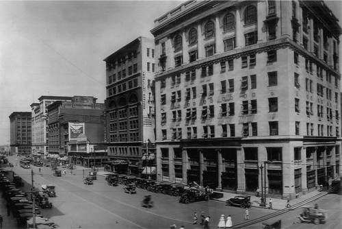
Tucker Boulevard 1917.jpg
Tucker Boulevard circa 1917 - Photo from the building's National Register nomination. The nine story building to the north as well as the tiny two story between have been replaced by a parking garage. Farther north, the former A.D. Brown Building, now the Meridian is the only building that has not been demolished or truncated.

IMG_9581.JPG
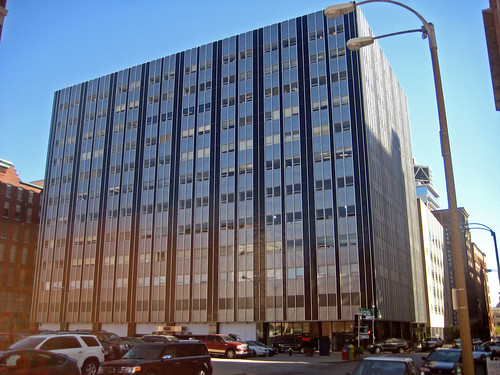
One block to the north and east at the northeast corner of 11th and Locust is another building early 20th century building which was "modernized". The Locust Building, which is home to the City's Community Development Agency and the St. Louis Development Corporation, at least retains the same number of windows as it did originally, although the height of the windows was reduced to a dimension slightly taller than the brick bands between the originals. There are no plans to unsheath this building, in fact the current owners have made some improvements in the last few years in keeping with the current modern design of the building.

1015 Locust before cladding.jpg
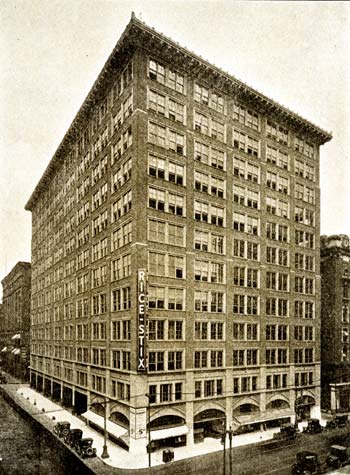
A photo of the building prior to its covering with aluminum curtain wall. The photo is from the former owner's now defunct website which gave a brief history of the building. The concrete frame structure was built as an annex for the giant Rice-Stix dry goods company which had previously built the Merchandise Mart building on Washington Avenue. A five story bridge still connects the upper floors of the two buildings. Rice-Stix also built an annex that now houses the 10th Street Lofts.

Friday, October 1, 2010

Hiding in Plain Sight

12th & Chouteau 1925.jpg
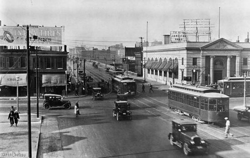
I was recently looking at a collection of historic Route 66 photographs including St. Louis when I stumbled upon this view above of 12th and Chouteau from 1925. I immediately thought of the nearly blank orange brick box that sits at the northeast corner of the intersection. The way it hugs Chouteau and the entrance of the Tucker Boulevard viaduct heading into Downtown had always made me suspect that it is older than it looks, but never did I imagine that the building began its life as the beautiful neoclassical bank pictured above. According to City property records, the bank was constructed in 1924.

IMG_9185.JPG
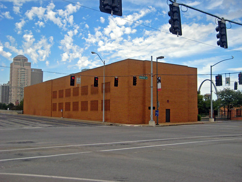
At some point, in the late 1960's or 1970's the building became part of Checkerboard Square, the headquarters of Nestle Purina, and was sheathed in orange brick to match several other buildings on the corporate campus.

IMG_9176.JPG
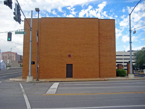
A steel security door centered on the blank brick front of 1111 Chouteau gives little clue of the former columned grand bank entrance. Only the projection of the center of the facade follows the form of the hidden architectural details.

IMG_9173.JPG
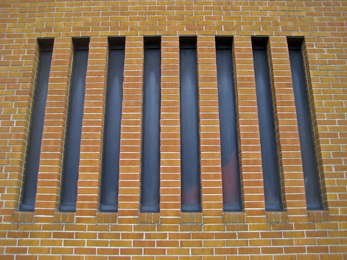
The seven double height arched windows which faced Tucker and no doubt opened into a grand 2-story banking hall have been reduced to a series of brick bars giving the building the appearance of a jail.

Picture 30.png
The east facade is not much better, with the brick bars continuing at the ground floor and a thin slot of strip windows at the second floor, which was likely inserted into the bank hall.

IMG_9181.JPG
I wondered what could be housed in this horribly re-muddled brick box? Maybe computer servers?, maybe the campus maintenance department? There is no signage on the public facades of the building even indicating it is part of Purina or what it contains. I was quite surprised to learn after a quick Google search that 1111 Chouteau is home to Checkmark Communications, Nestle Purina's in-house creative communications and design agency. What!? The staff of "creative communications and design agency" of a major corporation are housed in this thing? Maybe there would be more creativity going on if the orange brick skin was ripped off and those wonderful large windows opened again.

Monday, September 27, 2010

LRA & Preservation Board Spare the Green Flounder

Laura Costello, Director of the City's Land Reutilization Authority (LRA) spoke tonight to the Preservation Board asking for a 6 month extension from demolition for the green painted flounder house at 3533 Missouri Avenue. The house had been condemned for demolition by the Department of Public Safety last September. She said the LRA would like to do some special marketing for the house to find a someone to rehabilitate it including placing it on their Featured Properties List.

The 925 square foot home is located in the Benton Park National Register Historic District, making it eligible for Historic Rehabilitation Tax Credits. The unusual rear of the lot frame flounder is listed in the City's real estate records as being built in 1884. The Preservation Board voted to approve the extension.

Next, though the Preservation Board approved the demolition of 5148 Enright against the Cultural Resources staff recommendation. While as Cultural Resources Office Preservation Planner Bob Bettis testified the porch of this house needs some attention, the home itself is structurally sound without major damage. The Preservation Board agenda for the home shows an analysis of rehabilitation cost after factoring in Federal and State Historic Tax Credits at $112,200.00. The house is a contributing property in the Mount Cabanne - Raymond Place National Register Historic District.

18th Ward Alderman Terry Kennedy however testified in favor of demolition, stating that since the house to the east of 5148 Enright (vacant lot shown above) was demolished after an arson fire, and this one would probably be next in line for an arson fire. I'm not sure how this claim can be pointed at this house and not every other vacant home in the area? He did mention that the owner of the occupied home next door is having problems getting insurance. Again though, I find it hard to believe that no one would insure this owners home and this could theoretically be claimed as a reason to demolish every vacant house next to an occupied house in the City. None the less, the Preservation Board voted for demolition.

The Preservation Board also voted to allow the demolition of a Mid-Century Modern building at 3663 Forest Park upon the application of a building permit for a new five story Best Western hotel. The board wisely chose to hold the building permit requirement as recommended by the Cultural Resources staff. The developer tired to claim that a survey of the property could not be done without demolition of the building, but even Richard Callow, one of the few non-architect or engineers present called this bluff.

The design of the new hotel, while much better than what had been originally proposed in 2007, seems to have been downgraded from that shown last year in this Central West End Midtown Development report.

Wednesday, September 22, 2010

An Unrecognizable Intersection

Gaslight Sq tornado 1959 01.jpeg
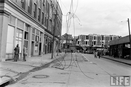
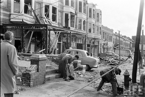
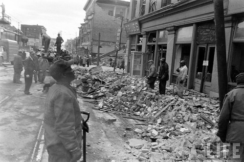
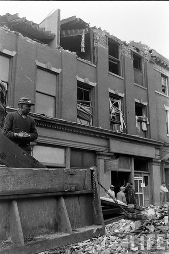
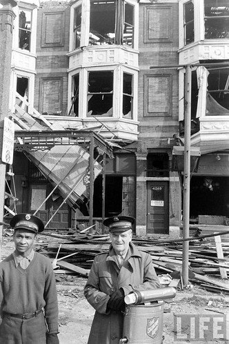
I'm a big fan of old photographs of St. Louis, particularly street scenes. I recently came across a link to search the image archives of Life Magazine through Google, and of course searched St. Louis. Beyond many fashion shots in WU's quad (which are fascinating), baseball, the zoo, Veiled Prophet, etc., a few images of major debris in the streets caught my eye. The images are simply labeled "St. Louis Tornado". The intersection above would otherwise have been almost unrecognizable, but my knowledge of the patterns of devastation brought by major tornadoes through St. Louis history told me that this must be 1959 and somewhere around Gaslight Square.

Gaslight Sq tornado 1959 02.jpeg
Everything visible in the first image has been gone since before my memory, so while I knew the general location, placing the intersection did not come immediately. After looking at a few more images, I recognized I recognized a row of buildings that I do remember, and realized the location was Boyle at Olive. What makes the intersection hard to place is not only the clearance of buildings, but the complete re-configuration of the intersection.

Gaslight Sq tornado 1959 03.jpeg
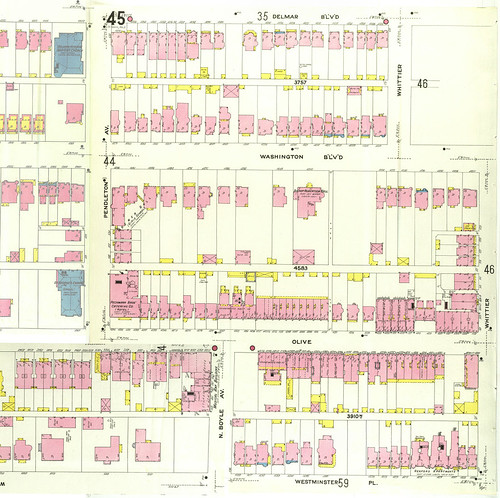
Looking east on Olive just west of Boyle. The building on the southwest corner of the intersection was known as the Musical Arts Building long before becoming home to Gaslight Square venues and had been since at least 1909 as its name appears on the Sanborn map below.

Gaslight Sq tornado 1959 04.jpeg
Damage to the Musical Arts building from the tornado was extensive, but not devastating and the building was repaired and put back into use.

Just three years later on the night of January 10th, 1962, a major fire struck the Musical Arts Building. The photos above and below are from a Post Dispatch photo gallery of the enormous fire caused by a grain explosion at Ralston Purina's mill on Gratiot that occurred the same night. The building just west of the Musical Arts in the photo above was one of the first to go prior to the mass demolitions for Citirama and can be seen in my second Gaslight post in 2007.
The aftermath of the fire left the building, sidewalks and street all coated in thick layers of ice. Like a cat with nine lives though the Musical Arts Building was re-built again. The building for many years housed the studio of artist Ernest Trova. According to the Post, the it was finally demolished sometime in the 1970's.
Boyle-Olive Sanborn.jpg
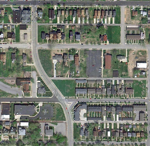
As this 1909 Sanborn Map of Gaslight Square shows, originally Boyle and Pendleton each ended in T intersections at Olive about 260 feet apart. At some point however, possibly due to perceived traffic problems around Gaslight Square, Boyle and Pendleton were joined by the taking of several properties, clearance through demolition and construction of a curved connector. South of Westminster Place, Boyle remains a standard street with 36 feet of pavement (two 10' driving lanes & two 8' lanes). The new connector however was built with a whopping 50 feet of pavement or four 12.5' lanes. For comparison, standard lane width for interstates is 12'.

Boyle-Olive Aerial.jpg
An aerial photo today shows the dramatic change that came with the reconfiguration of the streets. While a four way stop has been put in at Olive, the overbuilt infrastructure still has the feel of a high speed collector road in some far flung suburb. The architecture of the townhouses that have been built in the area, with the exception of a condo building at the southeast corner does not help the feeling of the road.

Gaslight Sq tornado 1959 06.jpeg
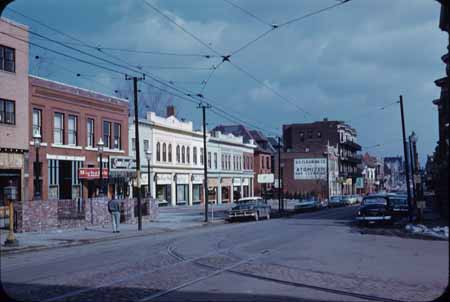
The building at the end of the T in the first photo survived the tornado, but as photos below from the Western Historical Manuscript Collection show, it was re-built as a stripped down ghost of its former self. The bays, while damaged, seemed repairable, but were stripped off along with the decorative brickwork only to be replaced with pairs of windows punched in a blank facade.

Except fro a coat of white paint, the only thing unaltered was the iron canopy extending over the terrace. This building was demolished along with others for the reconfiguration of Boyle and Pendleton.
Another view from the intersection looking east. The painted building in the center would survive until 2003. More photos of those can be seen in my first Gaslight Square post.

the new Gaslight Square
The "new" Gaslight Square looking east from Boyle. Photo by Marjie Kennedy. A fairly attractive 3-story condo building has since filled out the corner behind the columns. The only things recognizable from the old photos are the gas light poles and the Continental Building in the distance. The northeast and southwest corners of the intersection are still empty lots. Hopefully someday something worthy of this storied location will be built there.