Wednesday, August 20, 2008

Update: Drury Hotel would spare Lambskin Temple

Last night at a packed church in Forest Park Southeast, Drury Development presented a proposal to build a new hotel at the intersection of Kingshighway and Highway 40. In contrast to what was reported in the West End Word last week, the Lambskin Temple would not be demolished for the hotel. Most of the development land would come from surplus land that is leftover from reconfiguration of the 40/Kingshighway interchange. A spokesperson from MODOT was on hand and confirmed that they are in the process of seeing determining how the land would be decommissioned. She did say that they have agreed to return a triangular piece of land back to the City that was originally part of Forest Park prior to realignment of Kingshighway.

The proposal presented last night calls for two 16 story towers each containing 345 rooms. The east tower closer to the highway would be built first, then if it is successful and there is additional market demand, the second tower would be built. A three level below grade garage would contain most of the parking, although the site plan appears to contain some surface parking. Someone threw out a number that the total development could be around a $100 million investment.

Charles Drury stated that this would be the finest hotel of their holdings. He said that there would be a mix of room rates and levels from those affordable to families with children, to rooms that would "beat any Ritz Carlton".

Unfortunately to access the hotel, five to seven homes would be acquired and demolished in order to widen an existing alley behind the Lambskin Temple and other buildings along Kingshighway. The new access road would enter at the recently closed intersection of Oakland on the east side of Kingshighway. Drury said they would be fine with an access point directly into the front of the property from Kingshighway, but doubted that MODOT or the City would want that so close to the new interchange. This is something they should pursue further and could avoid demolition of homes.

The other issue with the access plan is that currently the neighborhood is closed off from Kingshighway, and apparently likes it that way, as many residents expressed that they did not want the through traffic. The issue then is how to handle circulation at the ends of the streets if they are blocked off from the new road.
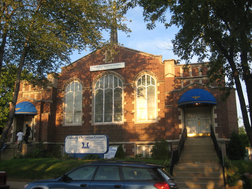
The meeting was held in the beautiful Calvary Christian Church the end of Gibson. Under the plan presented, the church property would be acquired. In keeping with Drury's laudable past preservation efforts Downtown, including saving the Fur Exchange as it had begun demolition, Charles Drury proposed that the church sanctuary would become the lobby of the second tower, which would contain nicer rooms. The church would apparently be raised off its foundation, moved aside, then placed back atop the new underground garage (not an inexpensive endeavor!).
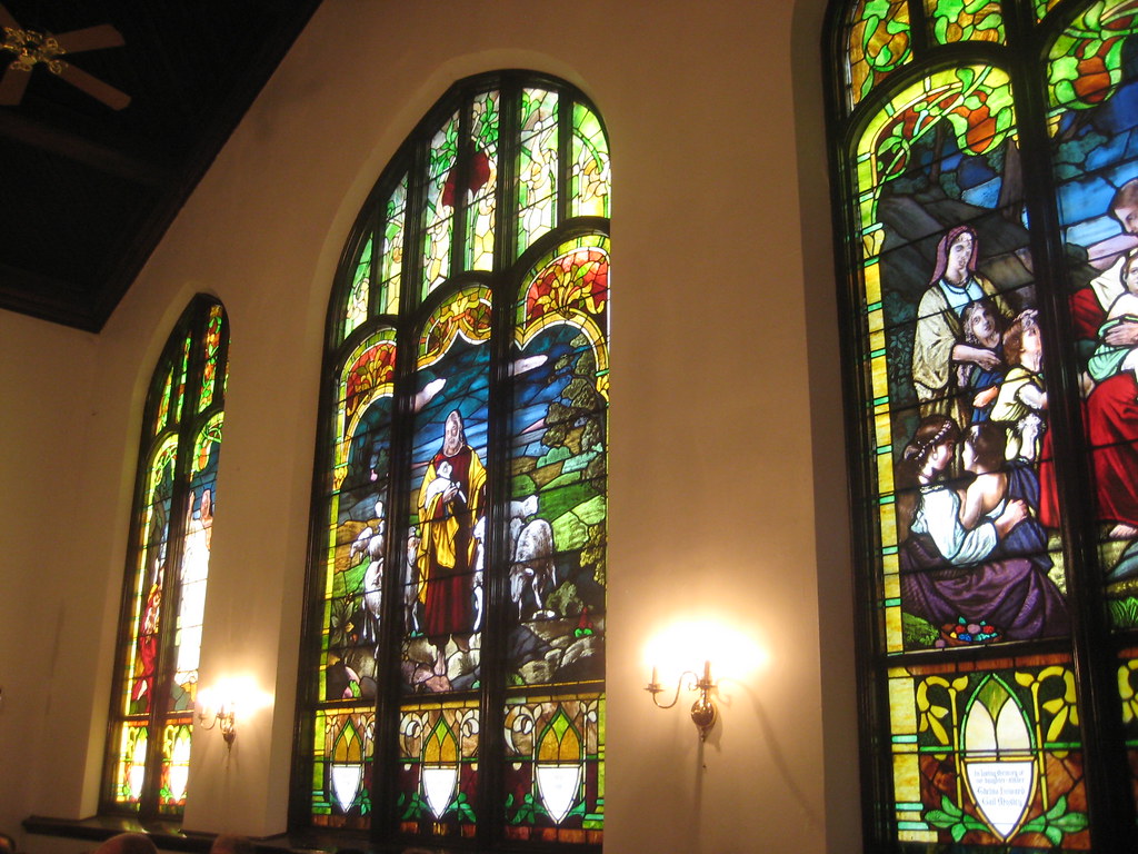
Stained glass windows at the rear of the church, and the beamed ceiling below

Timothy Drury held up a rendering of an earlier concept that has fortunately been scrapped that called for a single large continuous building creating a wall in front of the neighborhood. It kind of reminded me of a PoMo version of one of the Pruitt Iago towers. Another rendering of that plan is below. The triangle of green space is presumably the area MODOT has agreed to give back to Forest Park.
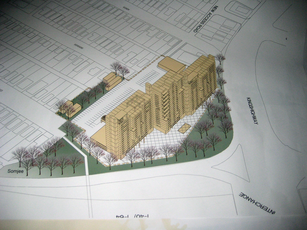
The Drury's stated that it is very early in the development process, and they have traffic studies, City and MODOT negotiations and approvals yet to be had, as well as acquiring mush of the land. The is good, because the while the proposal would be a great investment in the City, it needs to be done in a manner that does not turn its back on the neighborhood. The site plan needs serious help, as it presently looks like a very unfriendly place to be on foot. Both the CWE and FPSE are great walkable areas, and you should feel comfortable walking to and from the hotel buildings to Forest Park, the hospital complex and the surrounding areas. The towers themselves also could possibly use some work, although the detail was difficult to make out on the screen. Trying to fake the architecture of the historic surroundings is probably not the best approach. A good cue could be taken from BJC's Center for Advanced Medicine that fronts Forest Park Blvd., which while possibly influenced by some past styles, is very much rooted in the present without being a ticky tacky piece of roadside architecture like Drury's recently opened Chesterfield hotel. The proposal though overall was better than I expected, and a good start.

Monday, August 18, 2008

Update: Drury FPSE Hotel Plan Meeting is Tuesday, Aug 19(tomorrow), Not Today

Apparently the West End Word published the wrong date for the meeting where Drury's hotel plan for Kingshighway and Oakland will be presented. It is tomorrow, Tuesday August 19th at 7pm - same location stated earlier, the church located at 1034 S. Kingshighway (at Gibson). A neighborhood resident who commented on my post made me aware of the error.

Thursday, August 14, 2008

Drury plans to replace Lambskin Temple and other historic buildings with new hotel

Drury wants to replace this
With this!

This weeks West End Word reports that Drury hotels is proposing a new hotel on Kingshighway at Oakland. While the details have yet to be made public, the article reports that the historic Lambskin Temple, which was renovated several years ago as loft apartments could be demolished as part of the plan. Additionally, several houses and small apartment buildings in the area would likely be demolished as well. Drury Development has already begun knocking on peoples doors, offering to buy them out.

Below are a few photos from St. Louis CIN of buildings south of the Lambskin Temple that could be included in the buyout. While none of them are spectacular buildings individually, they make up an entire block face of the the Forest Park Southeast National Register Historic District. Just south of the Lambskin is a somewhat unusual house built entirely of stone instead of brick (see first photo, peeking out behind a tree... photo from waymarking.com)


While the idea of a hotel in this general location does make sense, and Drury has a great track record Downtown, with three unique hotels located in five renovated historic buildings, their recently completed hotel at Hampton and 44 does not inspire confidence about what might get built. The photo above (from their own website) of the new hotel shows a mostly Dryvit (fake stucco) building, that seems to be aspiring to be something it's not, in a suburban style sea of asphalt and cars. The aerial shot below shows an all to familiar scene in new construction with the building hugging the back of the lot and the surface parking lot taking the front seat This is why we need a new form-based zoning ordinance with build-to requirements.
Ironically the view from Esther Avenue behind the building is actually quite urban... of course there is no entrance on this side of the building.
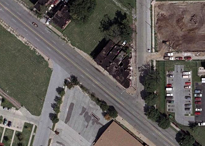
Instead of tearing down an entire block of historic buildings, Drury should look to build on land that has been left over by the reconfiguration of the Kingshighway/40 interchange. Changing the design to a single point interchange, land is now available where the cloverleaf ramps were formerly located. The land at the southeast corner of the interchange, shown below on a drawing from MODOT's website, could easily accommodate the new hotel development. The hotel would certainly be more visible from the highway as well, which would be good for business.
The photo below from MODOT's webcam shows the newly available land south of the new eastbound entrance ramp. The Word article mentioned that the City has looked at this land for recreation use, but is that the best use for the land? Would we really want recreation space right next to the highway? Please someone correct me if I'm wrong, but I thought the "replacement park" for the Hudlin playground was to be built off of Chouteau on or near the old Gasometer site?
Drury will be presenting the current proposed plan and getting feedback from residents and other stakeholders at a meeting of the Gibson Heights Neighborhood Association at 7pm next Monday, August 18th at the Church of Living God located at 1034 S. Kingshighway Blvd just north of the Lambskin Temple. To get there, take Arco west from Taylor and loop around the end of the block to the church which is next to Gibson. This U shaped loop does not actually connect to Kingshighway.

Tuesday, July 29, 2008

SLU Creates Superblock Between LBD & Grand Center, Hinders Development

Typically my posts here pertain to the loss of buildings. This one however targets the erosion of streets. Streets are literally the backbone of the City. Besides parks, they make up the majority of the area of the public realm. They not only carry the traffic of automobiles and pedestrians, but they define the character and scale of districts and neighborhoods, as well as delineate building and property frontage. The simplicity and flexibility of the urban street grid is what separates the City and its inner suburbs from post WWII suburbs which are more often than not defined by cul-de-sacs and overcrowded collector roads. Unfortunately, the City of St. Louis does not recognize the inherent value of it's streets and often gives away, yes, gives away these assets to private hands.

This is the case in Midtown where SLU has persuaded the City to vacate Josephine Baker between Locust and Washington
creating a superblock about 870 feet long. This is twice as long as today's city planners recommend to create a walkable environment in an urban area. Longer blocks also increase vehicle travel speeds due to the distance between intersections.
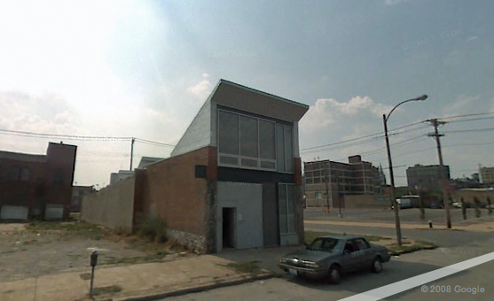
Several years ago, SLU bought properties in bulk in this area as a potential site for their new arena. Fortunately some owners held out, which spared dozens of buildings from the wrecking ball, and SLU was forced to build south of their campus on an old school site (which they demolished). Instead of divesting the properties north of Lindell, SLU seems to have gone into land-banking mode, holding and sitting on many properties, and demolishing several buildings, including the Locust Livery Stable, one of the oldest buildings in the area, to create vast surface parking lots. SLU owned two narrow lots on the east side of Josephine Baker, and this spring decided to take the street and two thirds of an alley as well. The legislation (page 23 - bills 8 & 19) breezed through the third read and passage at the Board of Alderman on July 3rd.

Presumably SLU will swallow the vacated stretch of Josephine Baker into a gian sea of surface parking which will likely egulf the vacant lots as well. SLU owns two architecturally significant buildings facing locust east of the expanding parking lot as well (see photo below), and it remains to be seen if they will attempt to demolish these as well.
SLU's hunger for needless parking lots has created a roadblock to local development. The parking lots and other properties SLU occupy a key location between the flourishing Locust Business District and the steadily emerging Grand Center. The area holds the opportunity to become the bridge that knits the two areas together, but instead remains a wasteland of vacancy holding the two adjoining districts back. Already on the superblock, the former Zane Williams Printing Co. building is being trasformed into the PW Shoe Lofts, and Carter Hendricks, one of the hold-out owners when SLU was aquiring for the arena, has done a fantastic renovation of his shop at 3336 Washington (photo below). According to an RFT article published last year, Jassen Johnson wanted to buy the Livery Stable and renovate it. Now the parking lot in its place and the closure of Josephine Baker create a black hole.
Further west, at the southern entrance to Grand Center, SLU's reluctance or inability to develop the the vacant land where they demolished the Marina Building during the now subdued development boom leaves a poor impression at a very important corner. Across Grand, a fenced surface parking lot north of Jusuit Hall greets visitors to the newly opened Kranzberg Cultural Arts Center in former Woolworth's building.
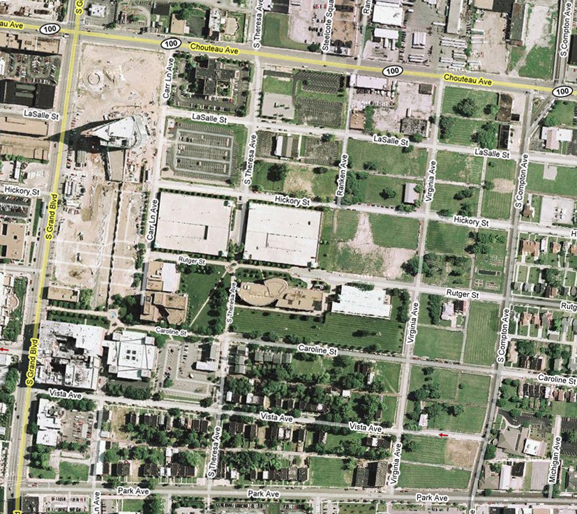
What will ultimately become of all this vacant land? Know one seems to know, and no one is putting any pressure on the university to do anything about it any time soon. This pattern follows closely to MO with which SLU has operated for years at its medical campus to the south. Stretching west from Compton, block after block of empty land gives the appearance of the aftermath a nuclear holocaust. Are they really going to build med-school related buildings on all that property in our life times? Hopefully we will not all be dead before we find out.

Friday, July 4, 2008

Regal Theater and nearby buildings

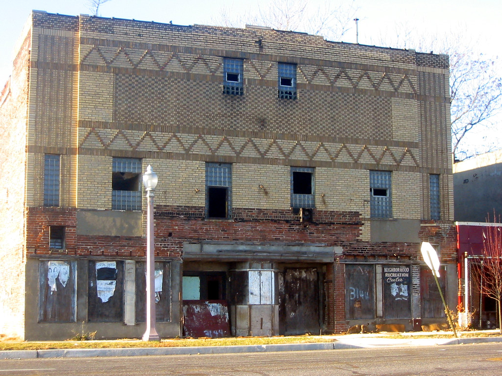
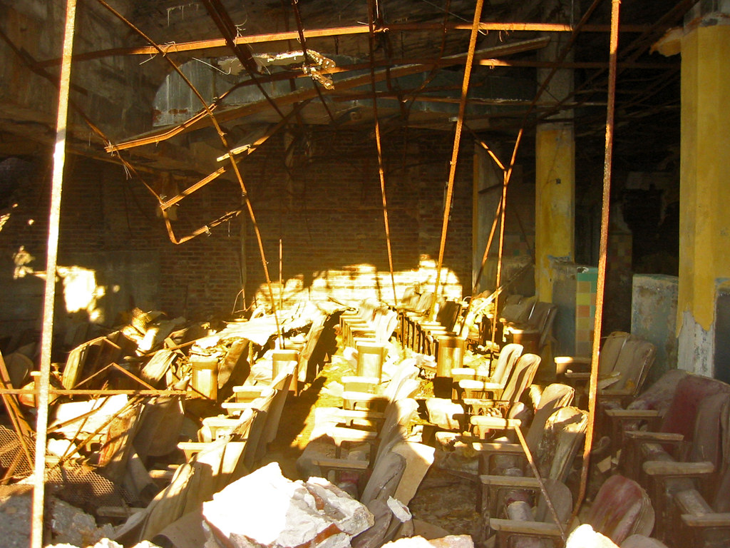
The Regal Theater like the soon to be demolished Shady Oak was a single screen neighborhood theater located at 3144 Martin Luther King just east of Compton. It was built for the Arthur chain in either 1931 (per Cinema Treasures) or 1937 (per Ecology of Absence). Its facade was fairly simple with art deco patterns of textured above where the marquee would have been located and windows of glass block (probably original) The first floor was clad in a blue marble like material, likely Vitrolite. A photo by Eric Post in his book Ghost Town shows some of this remaining at the center ticket booth as well as some lovely art deco decoration.
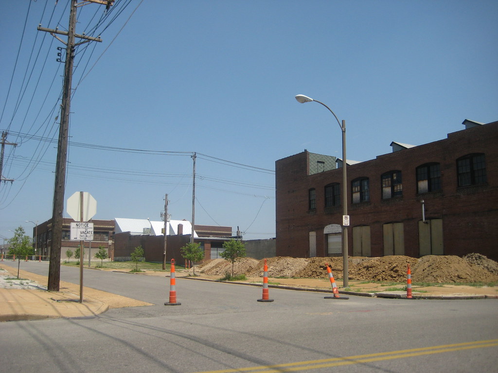
The building had been owned by LRA since 1986 and I presumed it was demolished (in 2006) for expansion of parking for a newer church just to the south. The church owned the smaller commercial buildings just west of the theater and those buildings were demolished shortly after the theater. City records show a 2007 aerial however shows both demolition sites as empty vacant lots and LRA still owning the theater site.
There was a sign on the building until its demolition that read "Neighborhood Recreation Center", which the area could probably use. I am not sure if it was ever used for this purpose since there were still seats in the auditorium at the time of demolition. The building could have also made good expansion space for the church.

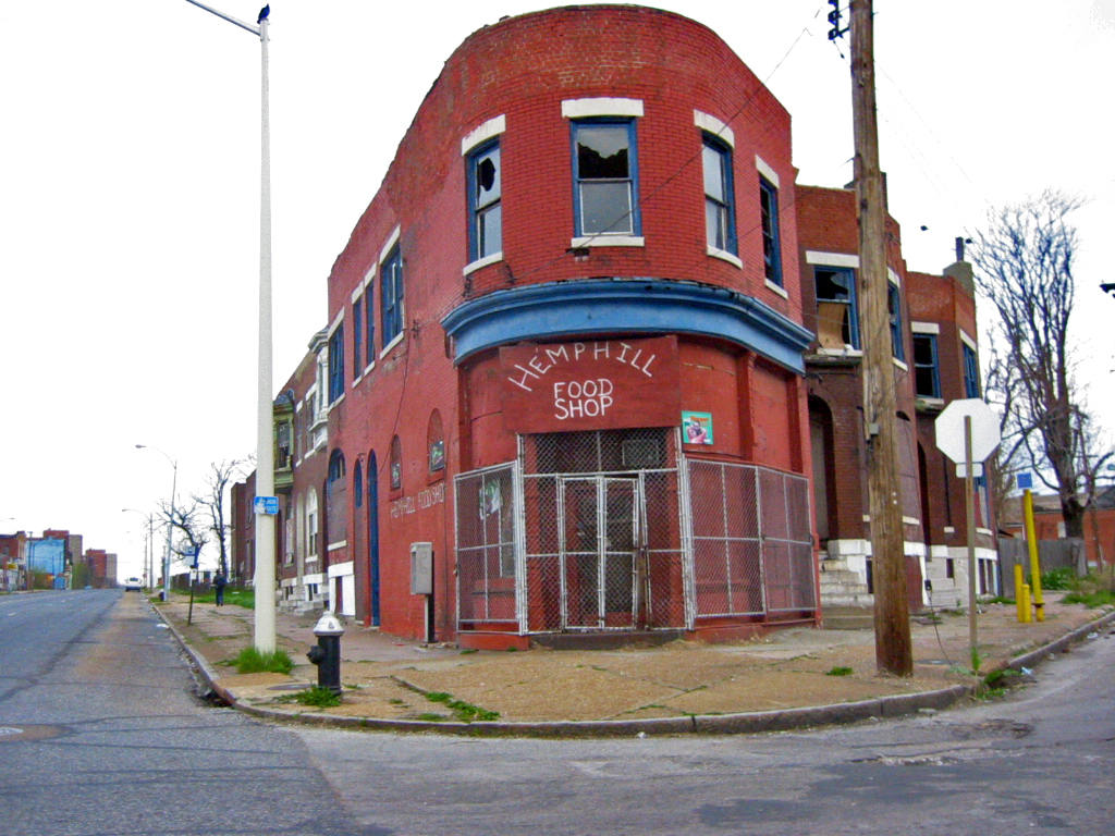
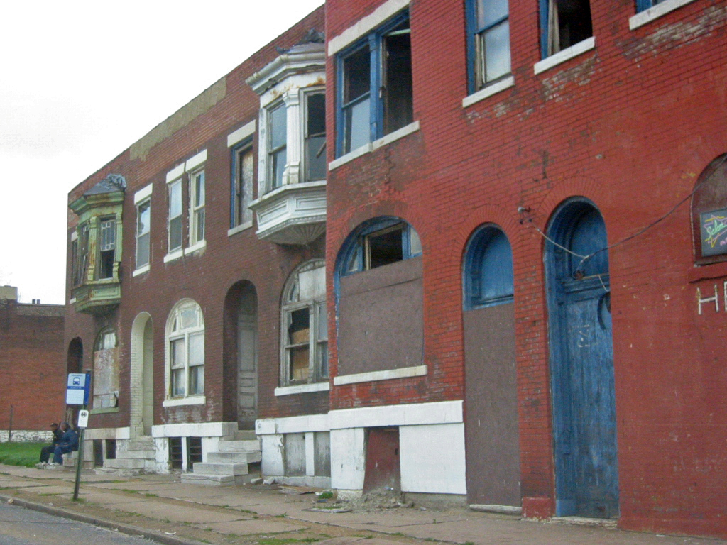
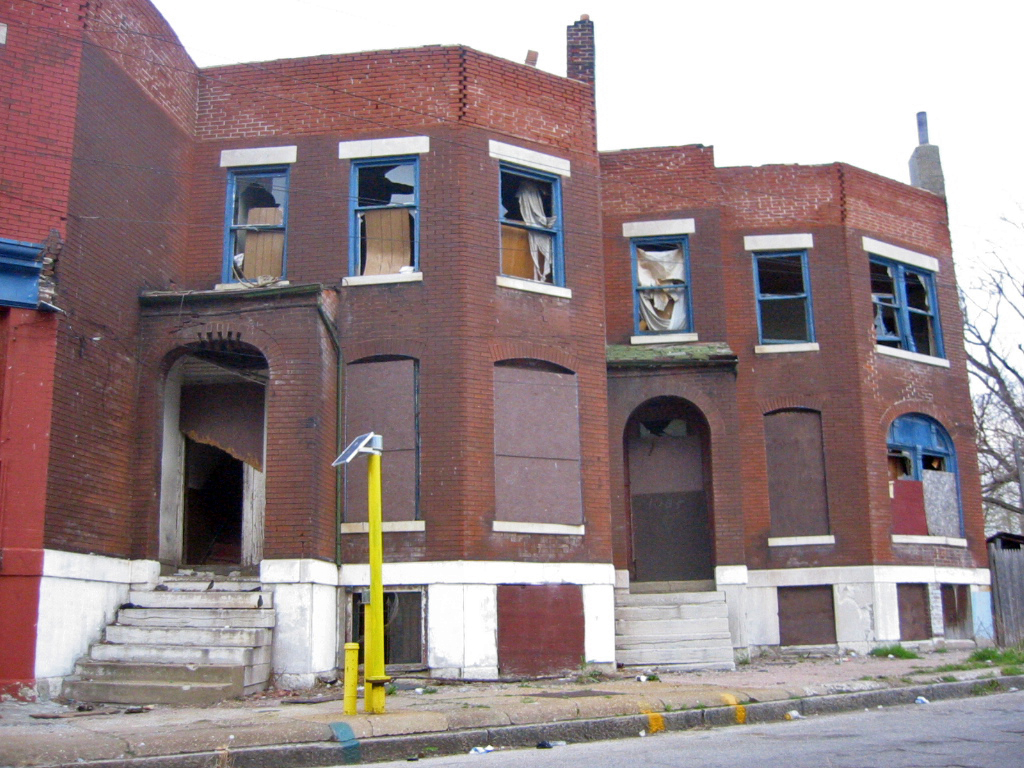
A block east across the street at the corner of MLK and Glasgow sat a small group of buildings which ingeniously held the 50 +/- degree angled corner. Along MLK stood 3 regularly shaped townhomes set back about 4 feet from the sidewalk. Attached to the east, the corner building boasted a graceful curved cast iron storefront with a small townhome unit on MLK and an additional apartment above the commercial space. North of this facing Glasgow were two small sawtoothed townhome units, with the second one having a depth of no more than 20 feet.
Like the theater, these buildings at MLK & Glasgow were owned by the local concentration camp for buildings, the LRA, and while abandoned and in need of rehabilitation, they were structurally in very sound condition. They were demolished seemingly for no reason with an "emergency" permit in July 2004.
As with the
recently lost corners of Glasgow & St. Louis Avenues, this group of buildings anchored the block with a wonderful way of handling a difficult site, and one which sadly is likely to not ever be repeated. Without the adoption of form based zoning or an "urban code", the ultimate replacement for once great corners like this will be suburban style mediocrity.

Wednesday, June 11, 2008

City of Clayton demands immediate demolition of Harris Armstrong's Vandervoort's Building

Everyone has heard that Centene is returning to their original plan to build in Clayton after playing Downtown St. Louis so that Clayton would cave-in and agree to unprecedented subsidies to lure them back. What seems to have missed the radar is that Harris Armstrong's unique Scruggs Vandervoort Barney aka the Library Limited building could have been saved at least for several years had it not been for the complete ignorance of the City of Clayton's politicians. My suspicions were confirmed in an article in last weeks West End Word stating that at least temporarily, the historic Harris Armstrong building was going to be spared.Under a revised plan, Centene was going to build a tower at the corner of Carondelet and Hanley first, while leaving the Harris Armstrong building standing for "temporary offices". The phase two second shorter tower at the corner of Forsyth & Hanley would be built at an "unspecified date in the future, dependant on market conditions". In others words, it may never have happened.It is unclear if Centene would have kept the Harris Armstrong building standing after construction was complete on the first tower, but they would have no real reason to demolish it until they planned to built on the site. They paid $12 million for the building and garage behind, so they might as well lease it out the building and get some revenue from it until the uncertain phase two, right?
Now reduced to "Bldg B", Centene could have converted the
building back to retail after building their first tower


Unfortunately, the City of Clayton demanded that the first tower go up on the corner of Forsyth and Hanley, triggering a demolition of the historic building this summer. Their concern is for revitalization of Forsyth. If Clayton was so concerned about Forsyth, they would have long ago created a master plan for active mixed use redevelopment of the street from the Parkway to Bemiston. Instead, they have sat and watched what was the premier retail street in St. Louis County become a series of vacant lots and underutilized properties characterized by inactive (non-retail) uses on the ground floors. At the same time, development of the former "Clayton hole" has moved the center of gravity one block south to Carondelet. A new tower with retail at Hanley and Carondelet would have nicely tied what is an isolated area with the core of downtown Clayton.