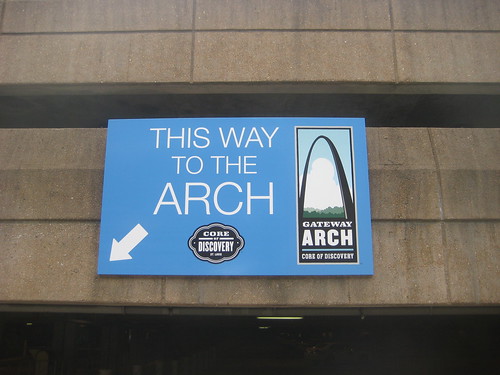
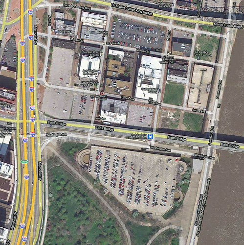
The design competition for improving the Arch grounds drew vastly different philosophies for connecting the park with the city along its north edge where the large parking structure has long been a barrier. The winning entry from MVVA proposes not just replacing the area of the garage, but complete removal of all existing infrastructure including Washington Avenue in order to push the park to the south face of the Eads Bridge.

A section through the Weiss Manfredi proposal shows how the grand stairs would have cut through the existing parking structure. The parking garage was completed in 1986, so with proper maintenance it should have several decades of useful life left.
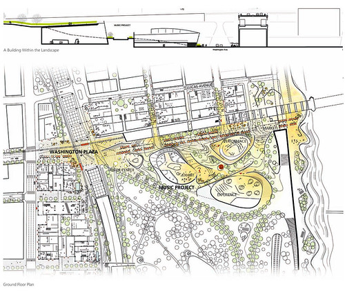
The Behnisch Team also proposed retaining Washington Avenue. Their proposal replaced the garage with a music themed museum. Between portions of the museum would be wide meandering spaces connecting Washington Avenue with the interior of the park.
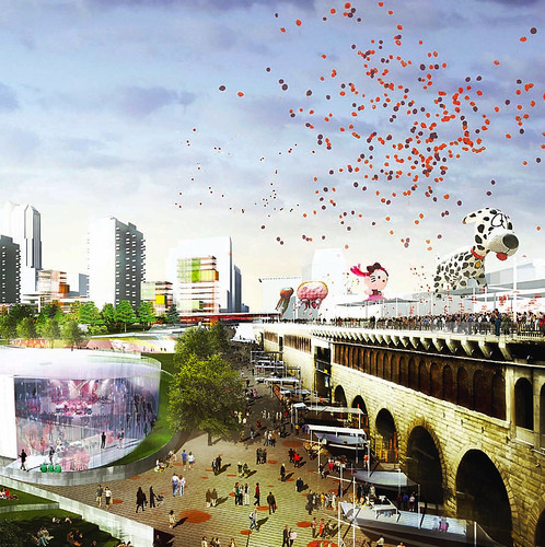
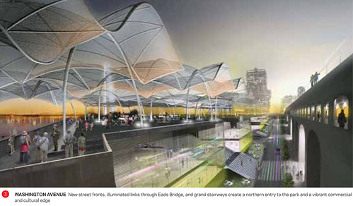
This rendering of the Behnisch Team competition entry shows the Washington Avenue corridor activated by people instead of cars. It is unclear from their narrative whether the lack of auto traffic would have been full-time or only at off-peak times.

As mentioned in my first post on this topic I feel that removal of the historic Washington Avenue connection from Memorial Drive to the riverfront will be extremely detrimental to Laclede's Landing. The Vision section of the Competition Manual stated: "This competition is about connections and weaving an urban park into the city fabric of St. Louis". Instead of truly integrating the park with the surrounding city grid, the MVVA plan eliminates part of the grid so that the Eads Bridge itself becomes a literal fortress like barrier between the park and the city. Instead of Washington Avenue continuing to connect the park to the grid of the city in three directions, it's elimination would leave two dead end streets truncated north of the bridge as the only connection between park and city. A third auto only right of way would serve as the entrance to a replacement underground garage on the Arch ground.
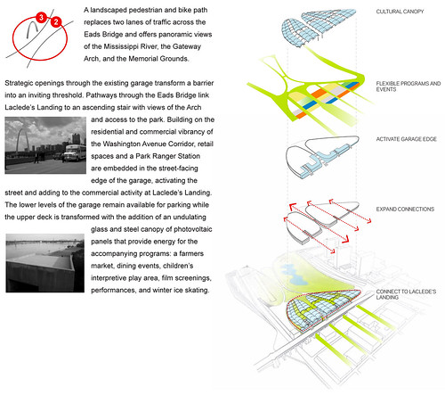
An alternative design philosophy was proposed by the Weiss Manfredi team. Instead of simply trying to push the boundaries of the park outward, Weiss Manfredi would have improved connections between the Arch grounds and the surrounding city by extending the city's grid into the park. Weiss Manfredi's proposal would have activated the Washington Avenue edge of the park by placing retail and a park ranger station into the existing parking structure as well as providing connection through by carving grand stairs through on axis with First & Second Streets as well as two north-sough pedestrian alleys in Laclede's Landing.

A section through the Weiss Manfredi proposal shows how the grand stairs would have cut through the existing parking structure. The parking garage was completed in 1986, so with proper maintenance it should have several decades of useful life left.

The Behnisch Team also proposed retaining Washington Avenue. Their proposal replaced the garage with a music themed museum. Between portions of the museum would be wide meandering spaces connecting Washington Avenue with the interior of the park.

This rendering of the Behnisch Team competition entry shows the Washington Avenue corridor activated by people instead of cars. It is unclear from their narrative whether the lack of auto traffic would have been full-time or only at off-peak times.
A reader comment from my second post on this topic questioned the need to drive to the riverfront. This is a valid question and I agree that driving to the riverfront is not always necessary or desirable however the ability to provide vehicular connection to Laclede's Landing at peak times such as weekend nights should not be forgotten.
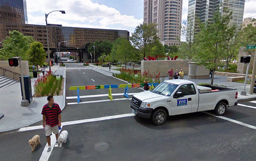
The closure of 9th Street at City Garden between Market and Chestnut during non-rush hour periods seems to be a good compromise between the need to keep the street grid open for traffic and the desire to expand pedestrian realms. This type of treatment could easily by used for improved and narrowed Washington Avenue along the north edge of the park.
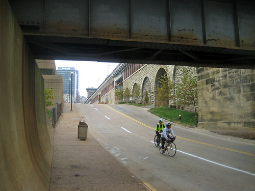
Of course our street grid is also essential for bikers to get around. If Washington Avenue is removed entirely East of Memorial Drive as currently planned by MVVA, bikers will be hard pressed to find a good route to the riverfront. While driving along the riverfront is not terribly exciting, biking there is a pleasant experience. Washington Avenue is the only decent route to the riverfront between the PSB and the MLK Bridges. The cobblestoned streets of Laclede's Landing are certainly not a good alternative.

I am baffled as to how anyone could think that removing a street will improve connections to anything.
ReplyDeleteMoDOT in building "connections" with the New 64 removed pedestrian bridges and the local blogging community remained silent.
ReplyDeleteRemoving one block of Washington also removes a connecting route for motorized travel but simple alternatives (like a pedestrian-bike path) would be sufficient and other motorized routes do exist. Reducing motorized vehicle traffic should be a top priority IMO if more people traffic is the goal. Or should we continue to favor tourists over residents?